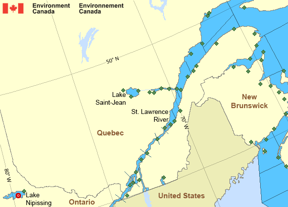
St. Lawrence - St. Lawrence River: Past 24 Hour Conditions
Lake Nipissing - 45152
08:00 AM EDT 19 September 2024Buoy position: 46.23N 79.72WDate / Time (EDT) |
Wind(knots) | Wave height(m) | Wave period(s) | Pressure(kPa) | Air temp(°C) | Water temp(°C) |
---|---|---|---|---|---|---|
19 September 2024 | ||||||
8:00 | ESE 3 gusts 4 | 0.03 | 1.7 | 101.8 | 18 | 20 |
7:00 | SE 3 gusts 4 | 0.04 | 1.6 | 101.7 | 18 | 20 |
6:00 | NE 2 gusts 4 | 0.05 | 1.6 | 101.7 | 18 | 20 |
5:00 | SW 3 gusts 3 | 0.05 | 1.6 | 101.7 | 18 | 20 |
4:00 | ESE 5 gusts 6 | 0.04 | 1.6 | 101.7 | 19 | 20 |
3:00 | E 2 gusts 3 | 0.02 | 1.6 | 101.7 | 19 | 21 |
2:00 | S 3 gusts 4 | 0.01 | 1.6 | 101.7 | 19 | 21 |
1:00 | SW 2 gusts 5 | 0.01 | N/A | 101.7 | 19 | 21 |
0:00 | WSW 1 gusts 8 | 0.02 | 1.6 | 101.7 | 20 | 21 |
18 September 2024 | ||||||
23:00 | WSW 3 gusts 4 | 0.01 | 1.6 | 101.7 | 20 | 21 |
22:00 | WSW 5 gusts 6 | 0.01 | 1.6 | 101.7 | 21 | 21 |
21:00 | SSE 5 gusts 6 | 0.01 | 1.7 | 101.7 | 21 | 21 |
20:00 | SSE 3 gusts 4 | 0.01 | 1.9 | 101.7 | 21 | 21 |
19:00 | E 2 gusts 3 | 0.02 | 1.6 | 101.7 | 23 | 21 |
18:00 | ENE 4 gusts 4 | 0.02 | 1.6 | 101.7 | 23 | 21 |
17:00 | NNE 5 gusts 6 | 0.03 | 1.6 | 101.7 | 23 | 21 |
16:00 | N 5 gusts 5 | 0.02 | 1.8 | 101.8 | 23 | 21 |
15:00 | N/A | N/A | N/A | N/A | N/A | N/A |
14:00 | NE 5 gusts 6 | 0.02 | 1.9 | 101.9 | 21 | 20 |
13:00 | NE 5 gusts 6 | 0.04 | 1.6 | 101.9 | 20 | 20 |
12:00 | E 5 gusts 6 | 0.07 | 1.6 | 102.0 | 20 | 20 |
11:00 | E 6 gusts 8 | 0.09 | 1.6 | 102.0 | 19 | 20 |
10:00 | ESE 6 gusts 8 | 0.12 | 1.9 | 102.1 | 18 | 20 |
9:00 | E 5 gusts 7 | 0.12 | 1.9 | 102.1 | 18 | 20 |
8:00 | E 7 gusts 9 | 0.14 | 1.7 | 102.1 | 17 | 20 |
If you require additional historical weather information please visit Fisheries and Oceans Canada
Zoom-in to make a selection
Legend:
Buoy
Land Station
St. Lawrence - St. Lawrence River Area
- Anticosti - northwestern half
- Anticosti - southeastern half
- Beauport to L'Isle-aux-Coudres
- Browns Bank
- Chaleur - Miscou
- Cornwall to Montréal
- Donnacona to Beauport
- Fundy
- Grand Manan
- Gulf - Magdalen - northern half
- Gulf - Magdalen - southern half
- Kingston to Cornwall
- Lake Memphrémagog - northern half
- Lake Nipissing
- Lake Saint-Jean
- Lurcher
- L'Isle-aux-Coudres to Tadoussac
- Montréal to Trois-Rivières
- Northumberland Strait
- Pointe à Michel to Pointe-des-Monts
- Pointe-des-Monts to Anticosti - northern half
- Pointe-des-Monts to Anticosti - southern half
- Richelieu River and Northern Lake Champlain
- Saguenay to Tadoussac
- Tadoussac to Pointe à Michel
- Trois-Rivières to Donnacona
Another Region
Features
New Predicting and Alerting Coastal Flooding Program
Find out about coastal flooding coverage, forecasts and warnings in your region
- Date modified: