
Strait of Georgia - north of Nanaimo: Past 24 Hour Conditions
South Brooks - 46132
05:00 PM PCT 16 November 2026Buoy position: 49.77N 127.88W| Date / Time (PCT) |
Wind(knots) | Wave height(m) | Wave period(s) | Pressure(kPa) | Air temp(°C) | Water temp(°C) |
|---|---|---|---|---|---|---|
| 16 November 2026 | ||||||
| 17:00 | S 10 gusts 15 | 4.85 | 13.3 | 101.6 | 11 | 12 |
| 16:00 | S 9 gusts 13 | 5.29 | 13.3 | 101.6 | 11 | 12 |
| 15:00 | SSW 8 gusts 10 | 4.99 | 14.3 | 101.6 | 11 | 12 |
| 14:00 | SW 8 gusts 12 | 5.43 | 14.3 | 101.6 | 11 | 12 |
| 13:00 | S 10 gusts 13 | 5.23 | 16.7 | 101.6 | 11 | 12 |
| 12:00 | SSW 9 gusts 12 | 5.50 | 14.3 | 101.6 | 11 | 12 |
| 11:00 | SSW 9 gusts 12 | 5.62 | 15.4 | 101.6 | 11 | 12 |
| 10:00 | SSW 5 gusts 8 | 5.50 | 15.4 | 101.5 | 10 | 12 |
| 9:00 | WSW 9 gusts 13 | 5.64 | 15.4 | 101.4 | 10 | 12 |
| 8:00 | SW 12 gusts 15 | 5.87 | 15.4 | 101.3 | 11 | 12 |
| 7:00 | SW 11 gusts 15 | 5.50 | 16.7 | 101.3 | 11 | 12 |
| 6:00 | SW 12 gusts 18 | 6.84 | 14.3 | 101.2 | 11 | 12 |
| 5:00 | S 12 gusts 18 | 6.23 | 14.3 | 101.2 | 11 | 12 |
| 4:00 | SSW 10 gusts 14 | 7.72 | 15.4 | 101.2 | 11 | 12 |
| 3:00 | SSW 11 gusts 15 | 6.90 | 15.4 | 101.1 | 11 | 12 |
| 2:00 | SW 11 gusts 16 | 7.70 | 14.3 | 101.0 | 11 | 12 |
| 1:00 | SW 12 gusts 19 | 7.74 | 15.4 | 100.9 | 11 | 12 |
| 0:00 | SW 9 gusts 15 | 7.35 | 14.3 | 100.9 | 9 | 12 |
| 15 November 2026 | ||||||
| 23:00 | SW 12 gusts 18 | 7.20 | 16.7 | 100.8 | 10 | 12 |
| 22:00 | SSW 14 gusts 18 | 7.22 | 15.4 | 100.6 | 11 | 12 |
| 21:00 | SSE 20 gusts 26 | 6.82 | 16.7 | 100.5 | 10 | 12 |
| 20:00 | SSE 24 gusts 29 | 6.06 | 16.7 | 100.4 | 11 | 12 |
| 19:00 | SSE 22 gusts 27 | 5.94 | 14.3 | 100.4 | 10 | 12 |
| 18:00 | S 24 gusts 29 | 6.85 | 18.2 | 100.4 | 9 | 12 |
| 17:00 | SSE 24 gusts 32 | 6.61 | 18.2 | 100.3 | 11 | 12 |
If you require additional historical weather information please visit Fisheries and Oceans Canada
Zoom-in to make a selection
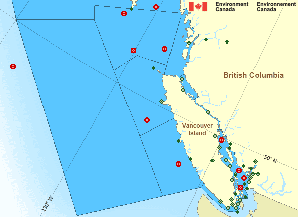
Legend:
 Buoy
 Land Station
Pacific - South Coast Area
- Bowie - southern half
- Central Coast from McInnes Island to Pine Island
- Explorer - northwestern half
- Explorer - southeastern half
- Haro Strait
- Hecate Strait - southern half
- Howe Sound
- Johnstone Strait
- Juan de Fuca Strait - central strait
- Juan de Fuca Strait - east entrance
- Juan de Fuca Strait - west entrance
- Queen Charlotte Sound - eastern half
- Queen Charlotte Sound - western half
- Queen Charlotte Strait
- Strait of Georgia - north of Nanaimo
- Strait of Georgia - south of Nanaimo
- West Coast Haida Gwaii - southern half
- West Coast Vancouver Island North
- West Coast Vancouver Island South
Another Region
Features
View yesterday's weather data

Check out weather conditions from the previous day using the Past Data link on each location page.
- Date modified: