
Tadoussac to Pointe à Michel
Forecast
Marine Forecast
Issued 03:00 AM EST 21 December 2024
Today Tonight and Sunday.
Gale warning in effect.
Wind northerly 15 to 25 knots backing to northwest 25 this afternoon except northwest 35 near the mouth of the Saguenay River. Wind diminishing to northwest 20 overnight except west 35 near the mouth of the Saguenay River. Wind northwest 20 except west 35 near the mouth of the Saguenay River Sunday.
Snow ending this evening. Visibility 1 mile or less in snow.
Risk of freezing spray today and Sunday.
Temperatures near minus 10.
Strong wind warning program has ended for the season.
Waves
Extended Forecast
Ice Forecast
Stay connected
 ATOM
ATOMWeather Conditions
Zoom-in to make a selection
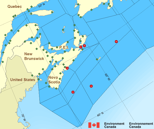
 Buoy
Buoy  Land Station
 Ice Conditions
Ice Forecasts
Issued 10:00 AM EST 20 December 2024 Today Tonight and SaturdayIce Edge
First ice edge estimated from Nova Scotia near 4553N 6155W to PrinceEdward Island near 4626N 6200W. Sea ice west of the ice edge.
Second ice edge estimated from Prince Edward Island near 4627N 6244W
to 4724N 6430W to 4841N 6357W to Gaspe Peninsula near 4852N 6413W.
Sea ice west of the ice edge.
Third ice edge estimated from Gaspe Peninsula near 4912N 6611W to
4947N 6541W to 4903N 6255W to Anticosti Island near 4904N 6216W. Sea
ice northwest then northeast of the ice edge.
Fourth ice edge estimated from Anticosti Island near 4955N 6358W to
4958N 6010W to 5103N 5751W to Newfoundland near 4900N 5830W. Sea ice
north then east of the ice edge.
Ice Coverage
Open water except 2 tenths new ice along parts of the coasts.
Warnings
Warnings (In effect)
Gale warning in effect
Tadoussac to Pointe à Michel
Issued 03:00 AM EST 21 December 2024'Gale' force winds of 34 to 47 knots are occurring or expected to occur in this marine area. Watch for updated statements. Please refer to the latest marine forecasts for further details and continue to monitor the situation through Canadian Coast Guard radio or Weatheradio stations.
Synopsis
Technical Marine Synopsis
Issued 3:00 AM EST 21 December 2024 Today Tonight and Sunday At 3:00 a.m. EST today ridge located on a line east-west overJames Bay.
By 7:00 p.m. EST Sunday ridge located on a line northeast-southwest
over Lake Ontario.
At 3:00 a.m. EST today low 992 mb located southeast of Nova Scotia.
By 7:00 a.m. EST Sunday departing low 965 mb located over Labrador
Sea.
Atlantic - Maritimes Area
- Anticosti - northwestern half
- Anticosti - southeastern half
- Banquereau
- Bras d'Or Lakes
- Browns Bank
- Cabot Strait - northern half
- Cabot Strait - southern half
- Chaleur - Miscou - eastern half
- Chaleur - Miscou - western half
- Eastern Shore - eastern half
- Eastern Shore - western half
- East Coast
- East Scotian Slope
- Fourchu
- Fundy
- Georges Bank
- Grand Manan
- Gulf - Magdalen - northeastern half
- Gulf - Magdalen - southwestern half
- Gulf - Port au Port
- Halifax Harbour and Approaches
- LaHave Bank
- Laurentian Fan
- Lurcher
- L'Isle-aux-Coudres to Tadoussac
- Northumberland Strait
- Pointe à Michel to Pointe-des-Monts
- Pointe-des-Monts to Anticosti - northern half
- Pointe-des-Monts to Anticosti - southern half
- Sable - eastern half
- Sable - western half
- Southeastern Grand Banks
- Southwestern Grand Banks
- Southwestern Shore
- Southwest Coast
- South Coast
- Tadoussac to Pointe à Michel
- West Scotian Slope
Another Region
Features
Canada's 10 most impactful weather stories of 2024

Find out which weather events made the list
- Date modified: