
Northeast Gulf
Forecast
Marine Forecast
Issued 10:00 AM NDT 02 April 2025
Today Tonight and Thursday.
Gale warning in effect.
Wind west 35 knots veering to northwest 35 this afternoon then diminishing to northwest 25 this evening. Wind diminishing to northwest 15 to 20 late overnight and to northwest 10 to 15 Thursday morning. Wind becoming light Thursday afternoon.
Flurries ending this evening.
Freezing spray warning in effect.
Over open water freezing spray ending Thursday morning.
Temperatures minus 5 falling to minus 10 overnight then rising to minus 5 Thursday evening.
Waves
Extended Forecast
Ice Forecast
Stay connected
 ATOM
ATOMWeather Conditions
Zoom-in to make a selection
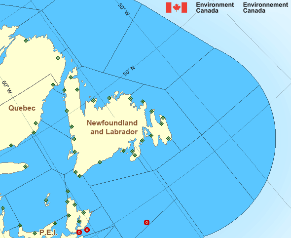
 Buoy
Buoy  Land Station
 Ice Conditions
Ice Forecasts
Issued 10:00 AM EDT 2 April 2025 Today Tonight and ThursdayIce Edge
First ice edge estimated from Cape Breton near 4620N 6017W to 4656N6003W to 4753N 6116W to 4754N 6327W to Anticosti Island near 4923N
6335W. Sea ice south and west of the ice edge.
Second ice edge estimated from Anticosti Island near 4948N 6315W to
4948N 5942W to 5031N 5752W to Newfoundland near 4847N 5846W. Sea ice
north and east of the ice edge.
Ice Coverage
Bergy water except 3 tenths first-year ice in the northern section.
Consolidated first-year ice along parts of the Quebec coast.
Iceberg Bulletin
Issued 4:54 PM EDT 1 April 2025Iceberg Limit
Iceberg limit at 0000 UTC 2 Apr estimated from Newfoundland near4658N 5404W to 4410N 5055W to 4410N 4620W to 4655N 4040W to 5230N
4450W to 5610N 4930W to 5900N 5620W to 6135N 5510W to 5900N 4735W
then eastwards.
Western iceberg limit at 0000 UTC 2 Apr estimated from Quebec near
5019N 6230W to Newfoundland near 4740N 5916W.
Iceberg Count
Less than 10 icebergs.Warnings
Warnings (In effect)
Gale warning in effect
Northeast Gulf
Issued 10:00 AM NDT 02 April 2025'Gale' force winds of 34 to 47 knots are occurring or expected to occur in this marine area. Watch for updated statements. Please refer to the latest marine forecasts for further details and continue to monitor the situation through Canadian Coast Guard radio or Weatheradio stations.
Freezing spray warning in effect
Northeast Gulf
Issued 10:00 AM NDT 02 April 2025Moderate or severe freezing spray is occurring or expected to occur in this marine area. Please refer to the latest marine forecasts for further details and continue to monitor the situation through Canadian Coast Guard radio or Weatheradio stations.
Synopsis
Technical Marine Synopsis
Issued 10:00 AM NDT 2 April 2025 Today Tonight and Thursday At 10:00 a.m. NDT today intensifying low 978 mb located oversouthern Labrador Sea.
By 10:00 a.m. NDT Thursday low 982 mb located over eastern
Labrador Sea.
Marine Weather Statement
Issued 9:37 AM NDT 2 April 2025 An intense low pressure system over the South Labrador Sea willremain nearly stationary today, then gradually track northwards on
Thursday. Winds will increase to strong to gale force southwest to
northwesterlies today in the wake of the low. Over extreme northern
waters, the northwesterlies will further increase to hurricane force
this evening. Winds will gradually diminish overnight tonight and
Thursday.
Marine interests are advised that a hurricane force wind warning is
in effect for Belle Isle Bank. Gale warnings are in effect for all
remaining waters except Northern Grand Banks and Southeastern Grand
Banks.
Marine interests are also advised that freezing spray warnings are in
effect for Strait of Belle Isle, Gulf waters, Northeast Coast, Belle
Isle Bank, and Funk Island Bank.
Atlantic - Newfoundland Area
- Anticosti
- Banquereau - northern half
- Banquereau - southern half
- Belle Isle Bank
- Bras d'Or Lakes
- Cabot Strait
- Chaleur - Miscou
- Eastern Shore - eastern half
- East Coast
- Fourchu
- Funk Island Bank
- Gulf - Magdalen - northeastern half
- Gulf - Magdalen - southwestern half
- Gulf - Port au Port
- Lake Melville
- Laurentian Fan
- Mid Labrador Coast
- Northeast Coast
- Northeast Gulf
- Northern Grand Banks
- Northumberland Strait
- Sable - eastern half
- Southeastern Grand Banks
- Southwestern Grand Banks
- Southwest Coast
- South Coast
- South Labrador Coast
- South Labrador Sea
- Strait of Belle Isle - eastern half
- Strait of Belle Isle - western half
Another Region
- Date modified: