
Belle Isle Bank
Forecast
Marine Forecast
Issued 10:00 AM NST 21 December 2024
Today Tonight and Sunday.
Storm warning in effect.
Wind east 20 knots increasing to northeast 35 this afternoon and to south 35 to 45 this evening except northeast 45 over northwestern sections tonight. Wind becoming west 45 to 55 Sunday morning then diminishing to northwest 35 to 45 Sunday afternoon.
Snow becoming rain or snow this evening then flurries Sunday morning. Visibility 1 mile or less in precipitation.
Temperatures minus 6 to zero rising to plus 2 this afternoon.
Waves
Extended Forecast
Ice Forecast
Stay connected
 ATOM
ATOMWeather Conditions
Zoom-in to make a selection
 Buoy
Buoy  Land Station
 Ice Conditions
Ice Forecasts
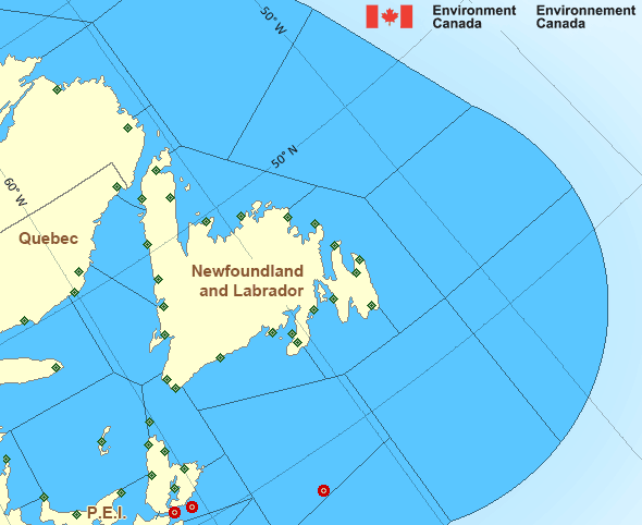
Belle Isle Bank
Issued 10:00 AM EST 20 December 2024 Today Tonight and SaturdayIce Edge
Ice edge estimated from Newfoundland near 5009N 5610W to 5141N 5512Wto 5325N 5531W to 5500N 5725W to 5552N 6004W to 6033N 6256W to 6200N
6050W then northeastward. Sea ice west of the ice edge.
Ice Coverage
Bergy water.
Ice Forecasts
Southeast Labrador Sea
Issued 10:00 AM EST 20 December 2024 Today Tonight and SaturdayIce Edge
Ice edge estimated from Newfoundland near 5009N 5610W to 5141N 5512Wto 5325N 5531W to 5500N 5725W to 5552N 6004W to 6033N 6256W to 6200N
6050W then northeastward. Sea ice west of the ice edge.
Ice Coverage
Forecasts available to mariners upon request.
Iceberg Bulletin
Belle Isle Bank
Issued 1:30 PM EST 20 December 2024Iceberg Limit
Iceberg limit at 0000 UTC 21 Dec estimated from the Labrador coastnear 5320N 5549W to 5145N 5030W to 5245N 4800W to 5345N 4800W to
5900N 5800W to 5945N 5230W then eastwards.
Iceberg Count
No confirmed icebergs except less than 10 icebergs north of theiceberg limit.
Iceberg Bulletin
Southeast Labrador Sea
Issued 1:30 PM EST 20 December 2024Iceberg Limit
Iceberg limit at 0000 UTC 21 Dec estimated from the Labrador coastnear 5320N 5549W to 5145N 5030W to 5245N 4800W to 5345N 4800W to
5900N 5800W to 5945N 5230W then eastwards.
Iceberg Count
Forecasts available to mariners upon request.Warnings
Warnings (In effect)
Storm warning in effect
Belle Isle Bank
Issued 10:00 AM NST 21 December 2024'Storm' force winds of 48 to 63 knots are occurring or expected to occur in this marine area. Please refer to the latest marine forecasts for further details and continue to monitor the situation through Canadian Coast Guard radio or Weatheradio stations.
Synopsis
Technical Marine Synopsis
Issued 10:00 AM NST 21 December 2024 Today Tonight and Sunday At 10:00 a.m. NST today intensifying low 988 mb located south ofNova Scotia.
By 10:00 a.m. NST Sunday low 964 mb located over Belle Isle Bank.
At 10:00 a.m. NST today ridge located over northern Belle Isle Bank.
By 3:30 p.m. NST today dissipating ridge located on a line east-west
over southern Labrador Sea.
Marine Weather Statement
Issued 9:50 AM NST 21 December 2024 A rapidly intensifying low pressure system will approach from thesouthwest today and quickly track northeastward across Newfoundland
tonight. Gale to storm force east to northeasterlies will spread
north and west of the low while gale to storm force southerlies will
develop to its east. Winds will shift to gale to storm force
northwest to southwesterlies in the wake of the low.
Marine interests are advised that storm warnings are in effect for
all waters except Southeastern Grand Banks where a gale warning is in
effect.
Marine interests are also advised that freezing spray warnings are in
effect for Gulf waters.
Atlantic - Newfoundland Area
- Anticosti - northwestern half
- Anticosti - southeastern half
- Banquereau
- Belle Isle Bank
- Bras d'Or Lakes
- Cabot Strait - northern half
- Cabot Strait - southern half
- Chaleur - Miscou - eastern half
- Chaleur - Miscou - western half
- Eastern Shore - eastern half
- East Coast
- Fourchu
- Funk Island Bank
- Gulf - Magdalen - northeastern half
- Gulf - Magdalen - southwestern half
- Gulf - Port au Port
Another Region
Features
Canada's 10 most impactful weather stories of 2024

Find out which weather events made the list
- Date modified: