
Gulf - Magdalen - northwestern half
Forecast
Marine Forecast
Issued 03:00 AM AST 22 November 2024
Today Tonight and Saturday.
Storm warning in effect.
Wind northeasterly 35 knots diminishing to northeast 30 near noon then increasing to northeast 35 Saturday morning. Wind increasing to northeast 50 Saturday afternoon then diminishing to easterly 35 Saturday evening.
Scattered showers changing to rain overnight.
Strong wind warning program has ended for the season.
Waves
Extended Forecast
Stay connected
 ATOM
ATOMWeather Conditions
Zoom-in to make a selection
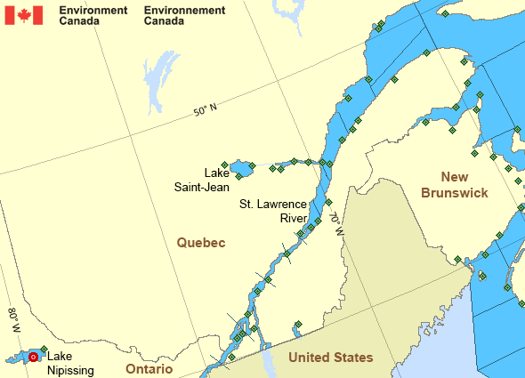
 Buoy
Buoy  Land Station
 Ice Conditions
Ice Forecasts
Issued 10:00 AM EDT 5 May 2024 Forecasts have ended for the season.Iceberg Bulletin
Issued 1:30 PM EST 21 November 2024Iceberg Limit
Iceberg limit at 0000 UTC 22 Nov estimated from the Labrador coastnear 5213N 5540W to 5245N 5415W to 5415N 5300W to 5900N 5615W to
5930N 5245W to 5720N 4510W then eastwards.
Iceberg Count
No confirmed icebergs.Warnings
Warnings (In effect)
Storm warning in effect
Gulf - Magdalen - northwestern half
Issued 03:00 AM AST 22 November 2024'Storm' force winds of 48 to 63 knots are occurring or expected to occur in this marine area. Please refer to the latest marine forecasts for further details and continue to monitor the situation through Canadian Coast Guard radio or Weatheradio stations.
Synopsis
Technical Marine Synopsis
Issued 3:00 AM AST 22 November 2024 Today Tonight and Saturday At 3:00 a.m. AST today trough located near Georges Bank.By 3:30 p.m. AST today weakening trough located from the Bay of
Fundy to East Scotian Slope.
At 8:00 p.m. AST tonight deepening low 996 mb located southwest
of the Marine District.
By 3:30 p.m. AST Saturday low 973 mb located over Nova Scotia.
Marine Weather Statement
Issued 2:50 AM AST 22 November 2024 A developing area of low pressure will deepen as it approachesThe southwestern marine district this evening. The low will
Cross Nova Scotia Saturday to lie near Prince Edward Island
Saturday evening. Winds will increase to gale to storm force
easterlies ahead of the low then shift to gale force
Southwesterlies south of it. Winds will become gale force
northwesterly over western waters in the wake of the low.
Marine interests are advised that storm warnings are in effect for
Cabot Strait, Gulf-Magdalen and Chaleur-Miscou - eastern half.
Gale warnings are in effect for all remaining waters.
Outlook for the start of the Southwest Nova lobster fishery.
Saturday..
For lfa34: winds variable 20 knots increasing to northwesterly
25 to 35 in the afternoon. Seas 2 to 3 metres building to 4 to 5
Late in the day.
For lfa33: winds northeasterly 25 to 35 knots shifting to
southwesterly 25 to 35 near noon then to northwesterly 30
In the evening. Seas 2 to 3 metres building to 4 to 5 late in the
day.
Sunday..Winds northwesterly 35 knots. Seas 3 to 4 metres.
Monday..Winds northwesterly 25 to 30 knots diminishing to 15 to 20
late in the day. Seas 2 to 3 metres subsiding to 1 to 2 late in the
day.
Tuesday..Light winds. Seas one metre or less.
St. Lawrence - St. Lawrence River Area
- Anticosti - northwestern half
- Anticosti - southeastern half
- Beauport to L'Isle-aux-Coudres
- Browns Bank
- Chaleur - Miscou - eastern half
- Chaleur - Miscou - western half
- Cornwall to Montréal
- Donnacona to Beauport
- Fundy
- Grand Manan
- Gulf - Magdalen - northwestern half
- Kingston to Cornwall
- Lake Memphrémagog - northern half
- Lake Nipissing
- Lake Saint-Jean
- Lurcher
- L'Isle-aux-Coudres to Tadoussac
- Montréal to Trois-Rivières
- Northumberland Strait
- Pointe à Michel to Pointe-des-Monts
- Pointe-des-Monts to Anticosti - northern half
- Pointe-des-Monts to Anticosti - southern half
- Richelieu River and Northern Lake Champlain
- Saguenay to Tadoussac
- Tadoussac to Pointe à Michel
- Trois-Rivières to Donnacona
Another Region
Features
WeatherCAN

Download and use the WeatherCAN app on your mobile device
- Date modified: