
Grand Manan
Forecast
Marine Forecast
Issued 03:30 PM ADT 12 October 2026
Tonight and Tuesday.
Strong wind warning in effect.
Wind southwesterly 10 to 15 knots increasing to northeast 30 early this evening then diminishing to east 15 Tuesday morning. Wind diminishing to light Tuesday afternoon then increasing to southeast 25 Tuesday evening.
Scattered showers ending Tuesday morning. Rain Tuesday evening.
Waves
Issued 05:00 AM ADT 12 October 2026
Today Tonight and Tuesday.
Seas 1 to 2 metres subsiding to 1 or less near noon then building
to 2 this evening. Seas subsiding to 1 near noon Tuesday.
Extended Forecast
Issued 03:30 PM ADT 12 October 2026
Wednesday
Wind southeast 30 knots diminishing to
westerly 25 in the afternoon.
Thursday
Wind northwest 25 knots.
Friday
Wind variable 15 knots increasing to southeast
25.
Stay connected
 ATOM
Weather Conditions
Zoom-in to make a selection
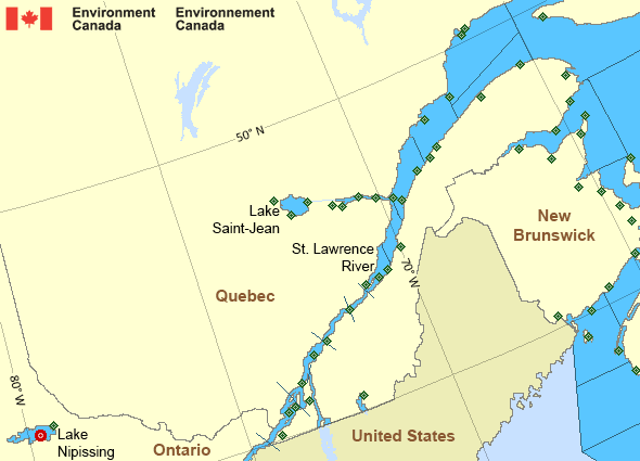
Legend:
 Buoy
 Land Station
Ice Conditions
Ice Forecasts
Issued 10:00 AM EDT 19 May 2026 Forecasts have ended for the season.Warnings
Warnings (In effect)
Strong wind warning in effect
Grand Manan
Issued 3:30 PM ADT 12 October 2026'Strong' winds of 20 to 33 knots are occurring or expected to occur in this marine area. Please refer to the latest marine forecasts for further details and continue to monitor the situation through Canadian Coast Guard radio.
Synopsis
Technical Marine Synopsis
Issued 3:30 PM ADT 12 October 2026 Tonight and Tuesday At 3:30 p.m. ADT today departing low 1001 mb located east ofNewfoundland.
At 3:30 p.m. ADT today low 997 mb located over East Scotian Slope.
By 3:00 a.m. ADT Tuesday departing low 992 mb located over the
Grand Banks.
At 3:30 p.m. ADT today high 1025 mb located over Quebec.
By 3:30 p.m. ADT Tuesday high 1022 mb located over the Gaspe
Peninsula.
Marine Weather Statement
Issued 3:18 PM ADT 12 October 2026 A low pressure system over East Scotian Slope will track east ofLaurentian Fan tonight. Strong to gale force southerlies will switch
to strong to gale force northeasterlies in its wake as a ridge moves
in from the northwest.
Marine interests are advised that gale warnings are in effect for
Georges Bank - southern half, West Scotian Slope - southern half,
eastern shore - eastern half, Sable - eastern half, East Scotian
Slope, Fourchu, Banquereau, Laurentian Fan and Cabot Strait.
Outlook for the start-up of the Upper Bay of Fundy lobster fishery.
Tonight...Winds light increasing to northeast 25 to 30 knots early
this evening. Choppy sea conditions this evening when winds will be
Running against the rising tide. Tuesday...Winds northeast 25 knots
diminishing to northeast 15 knots in the morning then to light near
noon then increasing to southeast 15 near midnight. Choppy sea
conditions in the morning when winds will run against the rising
Tide. Wednesday...Winds southeast 15 knots increasing to 25 knots in
the morning then becoming westerly 20 to 25 knots in the afternoon
then to northwest 25 late in the evening. Choppy sea conditions late
in the day when winds will be running against the ebbing tide.
St. Lawrence - St. Lawrence River Area
- Anticosti - northwestern half
- Anticosti - southeastern half
- Beauport to L'Isle-aux-Coudres
- Browns Bank
- Chaleur - Miscou - eastern half
- Chaleur - Miscou - western half
- Cornwall to Montréal
- Donnacona to Beauport
- Fundy
- Grand Manan
- Gulf - Magdalen - northeastern half
- Gulf - Magdalen - southwestern half
- Kingston to Cornwall
- Lake Memphrémagog - northern half
- Lake Nipissing
- Lake Saint-Jean
- Lurcher
- L'Isle-aux-Coudres to Tadoussac
- Montréal to Trois-Rivières
- Northumberland Strait
- Pointe à Michel to Pointe-des-Monts
- Pointe-des-Monts to Anticosti - northern half
- Pointe-des-Monts to Anticosti - southern half
- Richelieu River and Northern Lake Champlain
- Saguenay to Tadoussac
- Tadoussac to Pointe à Michel
- Trois-Rivières to Donnacona
Another Region
- Date modified: