
Browns Bank
Forecast
Marine Forecast
Issued 10:00 AM AST 06 November 2026
Today Tonight and Saturday.
Wind southwest 25 knots backing to southerly 20 near noon then diminishing to south 15 Saturday evening.
Periods of rain and fog patches with a risk of thunderstorms.
Waves
Issued 05:00 AM AST 06 November 2026
Today Tonight and Saturday.
Seas 1 to 2 metres.
Extended Forecast
Issued 03:00 AM AST 06 November 2026
Sunday
Wind southwest 25 knots.
Monday
Wind westerly 20 to 25 knots.
Tuesday
Wind northwest 20 knots.
Stay connected
 ATOM
Weather Conditions
Zoom-in to make a selection
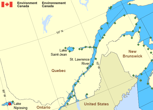
Legend:
 Buoy
 Land Station
Ice Conditions
Ice Forecasts
Issued 10:00 AM EDT 19 May 2026 Forecasts have ended for the season.Iceberg Bulletin
Issued 1:30 PM EST 5 November 2026Iceberg Limit
Iceberg limit at 0000 UTC 6 Nov estimated from Labrador near 5210N5545W to 5200N 5430W to 5300N 5100W to 5345N 5030W to 6000N 5800W to
6125N 5445W to 5910N 4710W then eastward.
Iceberg Count
No confirmed icebergs.Warnings
No watches or warnings in effect.
Synopsis
Technical Marine Synopsis
Issued 10:00 AM AST 6 November 2026 Today Tonight and Saturday At 10:00 a.m. AST today trough located from Labrador to theSt. Lawrence River.
By 3:00 a.m. AST Saturday departing trough located from Labrador
Sea to Nova Scotia.
At 3:00 a.m. AST Saturday low 1007 mb located over New England.
By 8:00 p.m. AST Saturday low 1003 mb located over the Gulf
of Maine.
At 10:00 a.m. AST today ridge located south of the Marine District.
By 3:00 a.m. AST Saturday departing ridge located southeast of
the Marine District.
Marine Weather Statement
Issued 9:33 AM AST 6 November 2026 Outlook for the start-up of the Southwest New Brunswick lobsterfishery
Lfa 36
Sunday..Winds variable 10 to 15 knots increasing to
Southwest 15 to 20 knots in the morning. Winds increasing to west 25
knots late in the afternoon. Seas 1 metre or less building to 1 to 2
metres in the afternoon.
Monday..Winds west 15 to 20 knots diminishing to southwest 10 to 15
knots near noon. Winds shifting to northwest 10 to 15 knots in the
evening. Seas 1 metre or less.
Tuesday..Winds northwest 15 to 20 knots becoming west 10 to 15 knots
in the afternoon. Seas 1 metre or less.
Lfa 38
Sunday..Winds southwest 10 to 15 knots increasing to southwest
15 to 20 knots in the morning. Becoming west 25 knots in the
afternoon then diminishing to west 15 to 20 knots near midnight.
Seas 1 metre or less building to 1 to 2 metres over northern sections
and to near 2 metres over southern sections in the morning.
Monday..Winds west 15 knots diminishing to southwest 10 to 15 knots
in the morning. Winds becoming northwest 15 to 20 knots in the
evening. Seas 1 to 2 metres subsiding to less than 1 metre late
Monday morning.
Tuesday..Winds northwest 15 to 20 knots becoming west 10 to 15 knots
near noon. Seas 1 metre or less over northern sections. Seas 1 to 2
metres over southern sections subsiding to 1 metre or less late
Tuesday morning.
St. Lawrence - St. Lawrence River Area
- Anticosti
- Beauport to L'Isle-aux-Coudres
- Browns Bank
- Chaleur - Miscou - eastern half
- Chaleur - Miscou - western half
- Cornwall to Montréal
- Donnacona to Beauport
- Fundy
- Grand Manan
- Gulf - Magdalen
- Kingston to Cornwall
- Lake Memphrémagog - northern half
- Lake Nipissing
- Lake Saint-Jean
- Lurcher
- L'Isle-aux-Coudres to Tadoussac
- Montréal to Trois-Rivières
- Northumberland Strait - western half
- Pointe à Michel to Pointe-des-Monts
- Pointe-des-Monts to Anticosti - northern half
- Pointe-des-Monts to Anticosti - southern half
- Richelieu River and Northern Lake Champlain
- Saguenay to Tadoussac
- Tadoussac to Pointe à Michel
- Trois-Rivières to Donnacona
Another Region
Features
View yesterday's weather data

Check out weather conditions from the previous day using the Past Data link on each location page.
- Date modified: