
Browns Bank
Forecast
Marine Forecast
Issued 03:00 AM AST 21 December 2024
Today Tonight and Sunday.
Gale warning in effect.
Wind northeasterly 40 knots diminishing to northwest 30 this morning and to northwest 20 early this evening. Wind northwest 20 Sunday.
Snow or rain changing to flurries near noon. Visibility 1 mile or less in precipitation.
Temperatures plus 1 falling to minus 5 Sunday afternoon.
Waves
Extended Forecast
Ice Forecast
Stay connected
 ATOM
ATOMWeather Conditions
Zoom-in to make a selection
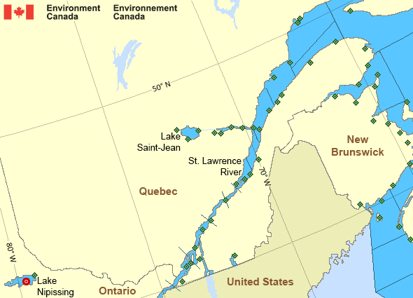
 Buoy
Buoy  Land Station
 Ice Conditions
Ice Forecasts
Issued 10:00 AM EST 20 December 2024 Today Tonight and SaturdayIce Edge
First ice edge estimated from Nova Scotia near 4553N 6155W to PrinceEdward Island near 4626N 6200W. Sea ice west of the ice edge.
Second ice edge estimated from Prince Edward Island near 4627N 6244W
to 4724N 6430W to 4841N 6357W to Gaspe Peninsula near 4852N 6413W.
Sea ice west of the ice edge.
Third ice edge estimated from Gaspe Peninsula near 4912N 6611W to
4947N 6541W to 4903N 6255W to Anticosti Island near 4904N 6216W. Sea
ice northwest then northeast of the ice edge.
Fourth ice edge estimated from Anticosti Island near 4955N 6358W to
4958N 6010W to 5103N 5751W to Newfoundland near 4900N 5830W. Sea ice
north then east of the ice edge.
Ice Coverage
Ice free.
Iceberg Bulletin
Issued 1:30 PM EST 20 December 2024Iceberg Limit
Iceberg limit at 0000 UTC 21 Dec estimated from the Labrador coastnear 5320N 5549W to 5145N 5030W to 5245N 4800W to 5345N 4800W to
5900N 5800W to 5945N 5230W then eastwards.
Iceberg Count
No confirmed icebergs.Warnings
Warnings (In effect)
Gale warning in effect
Browns Bank
Issued 03:00 AM AST 21 December 2024'Gale' force winds of 34 to 47 knots are occurring or expected to occur in this marine area. Watch for updated statements. Please refer to the latest marine forecasts for further details and continue to monitor the situation through Canadian Coast Guard radio or Weatheradio stations.
Synopsis
Technical Marine Synopsis
Issued 3:00 AM AST 21 December 2024 Today Tonight and Sunday At 3:00 a.m. AST today intensifying low 992 mb located overGeorges Bank.
By 8:00 p.m. AST tonight departing low 976 mb located over
southwestern Newfoundland.
At 10:00 p.m. AST tonight approaching ridge from 1036 mb high
located over the Great Lakes.
Marine Weather Statement
Issued 2:42 AM AST 21 December 2024 A low over Georges Bank will move across the marine district today tolie over Southwestern Newfoundland this evening then will depart.
Gale to storm force winds will prevail today.
Winds will diminish to strong to gale force northwesterlies in the
wake of the low tonight.
Marine interests are advised that storm warnings are in effect for
eastern shore - eastern half. Sable - eastern
Half, Fourchu, Banquereau, Laurentian Fan, Cabot Strait - northern
half, Gulf - Magdalen, and Anticosti - southeastern half.
Gale warnings are in effect for all remaining waters except Chaleur -
Miscou - western half.
Freezing spray warnings are in effect for Fundy, Northumberland
Strait, gulf- Magdalen, Chaleur - Miscou and Anticosti.
Higher than normal water levels are possible along north-facing
coastlines of the Southern Gulf of St. Lawrence during high tide
This afternoon into the evening.
St. Lawrence - St. Lawrence River Area
- Anticosti - northwestern half
- Anticosti - southeastern half
- Beauport to L'Isle-aux-Coudres
- Browns Bank
- Chaleur - Miscou - eastern half
- Chaleur - Miscou - western half
- Cornwall to Montréal
- Donnacona to Beauport
- Fundy
- Grand Manan
- Gulf - Magdalen - northeastern half
- Gulf - Magdalen - southwestern half
- Kingston to Cornwall
- Lake Memphrémagog - northern half
- Lake Nipissing
- Lake Saint-Jean
- Lurcher
- L'Isle-aux-Coudres to Tadoussac
- Montréal to Trois-Rivières
- Northumberland Strait
- Pointe à Michel to Pointe-des-Monts
- Pointe-des-Monts to Anticosti - northern half
- Pointe-des-Monts to Anticosti - southern half
- Richelieu River and Northern Lake Champlain
- Saguenay to Tadoussac
- Tadoussac to Pointe à Michel
- Trois-Rivières to Donnacona
Another Region
Features
Canada's 10 most impactful weather stories of 2024

Find out which weather events made the list
- Date modified: