
Browns Bank
Forecast
Marine Forecast
Issued 08:00 PM ADT 02 April 2025
Tonight and Thursday.
Wind light increasing to south 15 knots early Thursday morning and to southwest 30 Thursday afternoon.
Periods of rain Thursday. Fog patches forming Thursday afternoon.
Temperatures zero rising to plus 8 Thursday evening.
Waves
Issued 05:00 PM ADT 02 April 2025
Tonight and Thursday.
Seas 1 to 2 metres building to 2 to 3 late Thursday
afternoon.
Extended Forecast
Issued 03:30 PM ADT 02 April 2025
Friday
Wind west 25 to 30 knots.
Saturday
Wind northeast 20 to 25 knots.
Sunday
Wind south 30 knots.
Ice Forecast
Stay connected
 ATOM
ATOMWeather Conditions
Zoom-in to make a selection
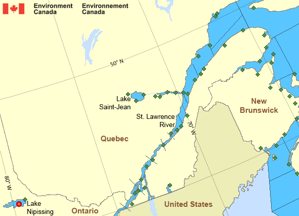
Legend:
 Buoy
Buoy  Land Station
 Ice Conditions
Ice Forecasts
Issued 10:00 AM EDT 2 April 2025 Today Tonight and ThursdayIce Edge
First ice edge estimated from Cape Breton near 4620N 6017W to 4656N6003W to 4753N 6116W to 4754N 6327W to Anticosti Island near 4923N
6335W. Sea ice south and west of the ice edge.
Second ice edge estimated from Anticosti Island near 4948N 6315W to
4948N 5942W to 5031N 5752W to Newfoundland near 4847N 5846W. Sea ice
north and east of the ice edge.
Ice Coverage
Ice free.
Iceberg Bulletin
Issued 3:04 PM EDT 2 April 2025Iceberg Limit
Iceberg limit at 0000 UTC 3 Apr estimated from Newfoundland near4658N 5404W to 4410N 5055W to 4410N 4620W to 4655N 4040W to 5230N
4450W to 5610N 4930W to 5900N 5620W to 6135N 5510W to 5900N 4735W
then eastwards.
Western iceberg limit at 0000 UTC 3 Apr estimated from Quebec near
5019N 6230W to 4855N 6100W to Newfoundland near 4740N 5916W.
Iceberg Count
No confirmed icebergs.Warnings
No watches or warnings in effect.
Synopsis
Technical Marine Synopsis
Issued 8:00 PM ADT 2 April 2025 Tonight and Thursday At 8:00 p.m. ADT tonight departing cold front located southeastof the Grand Banks.
At 8:00 p.m. ADT tonight ridge located over Quebec.
By 3:30 p.m. ADT Thursday ridge located on a line
northwest-southeast over the eastern Marine District.
At 3:30 p.m. ADT Thursday approaching warm front located over Maine.
Marine Weather Statement
Issued 7:44 PM ADT 2 April 2025 A cold front east of the marine district will continue to track awayfrom the region tonight. Strong to gale force northwesterlies behind
this cold front weaken as a ridge of high pressure builds in from the
west tonight.
Marine interests are advised that gale warnings are in effect for
Banquereau - northern half and Cabot Strait. Freezing spray warnings
are in effect for Cabot Strait, Gulf - Magdalen - northeastern half,
and Anticosti.
St. Lawrence - St. Lawrence River Area
- Anticosti
- Beauport to L'Isle-aux-Coudres
- Browns Bank
- Chaleur - Miscou
- Cornwall to Montréal
- Donnacona to Beauport
- Fundy
- Grand Manan
- Gulf - Magdalen - northeastern half
- Gulf - Magdalen - southwestern half
- Kingston to Cornwall
- Lake Memphrémagog - northern half
- Lake Nipissing
- Lake Saint-Jean
- Lurcher
- L'Isle-aux-Coudres to Tadoussac
- Montréal to Trois-Rivières
- Northumberland Strait
- Pointe à Michel to Pointe-des-Monts
- Pointe-des-Monts to Anticosti - northern half
- Pointe-des-Monts to Anticosti - southern half
- Richelieu River and Northern Lake Champlain
- Saguenay to Tadoussac
- Tadoussac to Pointe à Michel
- Trois-Rivières to Donnacona
Another Region
- Date modified: