
Browns Bank
Forecast
Marine Forecast
Issued 03:30 PM AST 14 December 2024
Tonight and Sunday.
Wind northwest 20 knots veering to north 15 early this evening then diminishing to light late Sunday morning.
Flurries ending Sunday morning.
Temperatures near plus 1.
Waves
Issued 05:00 PM AST 14 December 2024
Tonight and Sunday.
Seas 1 to 2 metres subsiding to 1 or less near noon
Sunday.
Extended Forecast
Issued 03:30 PM AST 14 December 2024
Monday
Wind light.
Tuesday
Wind south 20 knots increasing to southwest
30.
Wednesday
Wind west 20 knots diminishing to
light.
Ice Forecast
Stay connected
 ATOM
ATOMWeather Conditions
Zoom-in to make a selection
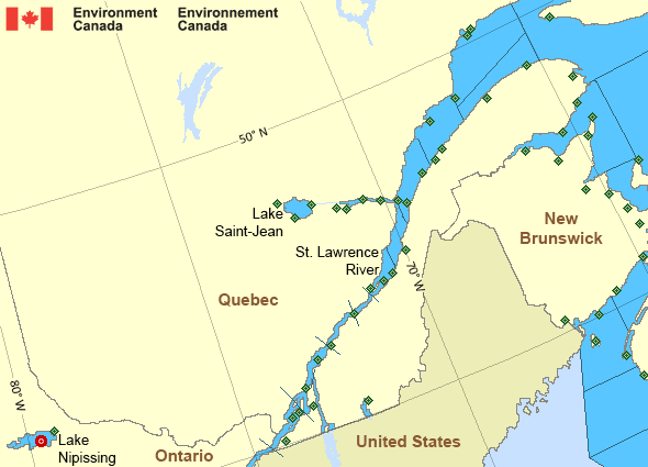
Legend:
 Buoy
Buoy  Land Station
 Ice Conditions
Ice Forecasts
Issued 10:00 AM EST 14 December 2024 Today Tonight and SundayIce Edge
First ice edge estimated from Nova Scotia near 4548N 6308W to PrinceEdward Island near 4603N 6302W. Sea ice west of the ice edge.
Second ice edge estimated from Prince Edward Island near 4626N 6308W
to 4729N 6428W to 4838N 6357W to Gaspe Peninsula near 4851N 6412W.
Sea ice west of the ice edge.
Third ice edge estimated from Quebec near 4845N 6750W to 4908N 6741W
to 4946N 6505W to Anticosti Island near 4935N 6346W. Sea ice
southwest then north of the ice edge.
Fourth ice edge estimated from Anticosti Island near 4956N 6403W to
4958N 6010W to Quebec near 5126N 5733W. Sea ice north of the ice
edge.
Ice Coverage
Ice free.
Iceberg Bulletin
Issued 1:30 PM EST 14 December 2024Iceberg Limit
Iceberg limit at 0000 UTC 15 Dec estimated from the Labrador coastnear 5320N 5549W to 5245N 5230W to 5245N 4930W to 5415N 4930W to
5900N 5800W to 5945N 5230W to 5835N 4625W then eastwards.
Iceberg Count
No confirmed icebergs.Warnings
No watches or warnings in effect.
Synopsis
Technical Marine Synopsis
Issued 3:30 PM AST 14 December 2024 Tonight and Sunday At 3:30 p.m. AST today departing trough located east of the MarineDistrict.
At 3:30 p.m. AST today high 1049 mb located over southern Quebec.
By 3:30 p.m. AST Sunday high 1046 mb located over the Gulf of Maine.
Marine Weather Statement
Issued 3:13 PM AST 14 December 2024 Marine interests are advised that a freezing spray warning is ineffect for Anticosti.
St. Lawrence - St. Lawrence River Area
- Anticosti
- Beauport to L'Isle-aux-Coudres
- Browns Bank
- Chaleur - Miscou
- Cornwall to Montréal
- Donnacona to Beauport
- Fundy
- Grand Manan
- Gulf - Magdalen - northeastern half
- Gulf - Magdalen - southwestern half
- Kingston to Cornwall
- Lake Memphrémagog - northern half
- Lake Nipissing
- Lake Saint-Jean
- Lurcher
- L'Isle-aux-Coudres to Tadoussac
- Montréal to Trois-Rivières
- Northumberland Strait - western half
- Pointe à Michel to Pointe-des-Monts
- Pointe-des-Monts to Anticosti - northern half
- Pointe-des-Monts to Anticosti - southern half
- Richelieu River and Northern Lake Champlain
- Saguenay to Tadoussac
- Tadoussac to Pointe à Michel
- Trois-Rivières to Donnacona
Another Region
Features
Canada's 10 most impactful weather stories of 2024

Find out which weather events made the list
- Date modified: