Language selection

Weather shortcuts

Kingston to Cornwall

Forecast

Marine Forecast

Issued 03:00 AM EDT 12 September 2026

Today Tonight and Sunday.

Wind light becoming south 10 knots near noon then veering to southwest 10 overnight. Wind increasing to west 15 Sunday afternoon.

Scattered showers overnight and Sunday morning with a risk of thunderstorms. Scattered showers Sunday evening.

Extended Forecast

Issued 03:00 AM EDT 12 September 2026
Monday Wind light.
Tuesday Wind light becoming south 15 knots.
Wednesday Wind southwest 15 knots diminishing to light.

Stay connected

ATOM

Weather Conditions

Skip Image

Zoom-in to make a selection

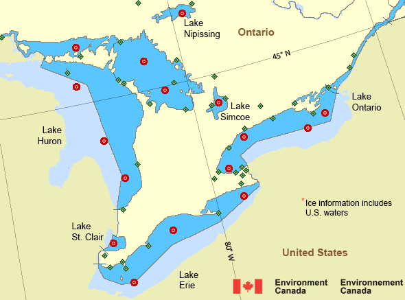
Map of Great Lakes - Lake Erie and Lake Ontario marine weather areas Harrow AAFC Hamilton Munro Int'l Airport CFB Trenton Erieau Toronto City Centre Airport Point Pelee Peterborough Municipal Airport Burlington Lift Bridge Point Petre Cobourg Oshawa Executive Airport South Lake Huron - 45149 Port Colborne Brockville Gore Bay-Manitoulin Airport North Bay Airport Greater Sudbury Airport Killarney Sault Ste. Marie Airport Ajax - 45159 North Channel - 45154 Lake Nipissing - 45152 Lake Simcoe - 45151 Windsor Airport Lake St Clair - 45147 South Georgian Bay - 45143 Port Colborne - 45142 Grimsby - 45139 Georgian Bay - 45137 Prince Edward Point - 45135 Port Stanley - 45132 Welland-Pelham Grenadier Island Kingston Airport Collingwood Lagoon City Muskoka Airport Parry Sound Harbour Lake Simcoe Regional Airport Wiarton Airport Western Islands Sarnia Chris Hadfield Airport Vineland Station Southeast Shoal St. Catharines / Niagara District Airport Goderich Port Weller Long Point Tobermory
Legend:
buoy Buoy
land station Land Station
Ice Conditions

There is no ice forecast issued for this area.

Warnings

No watches or warnings in effect.

Synopsis

Technical Marine Synopsis

Issued 3:00 AM EDT 12 September 2026 Today Tonight and Sunday At 3:00 a.m. EDT today ridge located on a line northeast-southwest
over the southern St. Lawrence River.
By 3:00 a.m. EDT Sunday ridge located east of Nova Scotia.

At 3:00 a.m. EDT today cold front from 988 mb low located on a
line northeast-southwest over northwestern Ontario.
By 3:00 a.m. EDT Sunday cold front from 988 mb low located on a
line northeast-southwest over central Ontario.

Great Lakes - Lake Erie and Lake Ontario Area

Another Region

Features

Colour-coded weather alerts

Learn more about weather alerting in Canada

Improved storm alerts

Learn more about targeted warnings for severe thunderstorms and tornadoes

Date modified: