Language selection

Weather shortcuts

Cornwall to Montréal

Forecast

Marine Forecast

Issued 03:07 PM EDT 07 September 2024

Tonight and Sunday.

Strong wind warning in effect.

Wind southwest 15 to 25 knots diminishing to light early this evening then increasing to southwest 20 to 30 early Sunday morning.

Showers ending near midnight. Scattered showers Sunday. Visibility as low as 1 mile in showers.

Extended Forecast

Issued 06:00 PM EDT 07 September 2024
Monday Wind southwest 15 knots increasing to southwest 15 to 25 in the morning.
Tuesday Wind northwest 10 to 15 knots diminishing to light late in the day.
Wednesday Wind southwest 10 to 15 knots.

Stay connected

ATOM

Weather Conditions

Skip Image

Zoom-in to make a selection

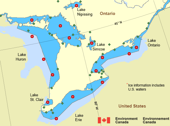
Map of Great Lakes - Lake Erie and Lake Ontario marine weather areas N Huron - 45003 W Erie - 45005 S Huron - 45008 Lake Ontario - 45012 Port Stanley - 45132 Prince Edward Point - 45135 Georgian Bay - 45137 Grimsby - 45139 Port Colborne - 45142 South Georgian Bay - 45143 Lake St Clair - 45147 South Lake Huron - 45149 Lake Simcoe - 45151 Lake Nipissing - 45152 North Channel - 45154 Ajax - 45159 Sault Ste. Marie Airport Killarney Greater Sudbury Airport North Bay Airport Gore Bay-Manitoulin Airport Great Duck Island Brockville Grenadier Island Kingston Airport Collingwood Lagoon City Muskoka Airport Parry Sound Harbour Lake Simcoe Regional Airport Wiarton Airport Western Islands Cove Island Goderich Sarnia Chris Hadfield Airport Tobermory Harrow AAFC Long Point Port Weller St. Catharines / Niagara District Airport Southeast Shoal Vineland Station Welland-Pelham Windsor Airport Port Colborne Erieau Point Pelee Burlington Lift Bridge Cobourg Hamilton Munro Int'l Airport Oshawa Executive Airport Point Petre Toronto City Centre Airport CFB Trenton Peterborough Municipal Airport
Legend:
buoy Buoy
land station Land Station
Ice Conditions

There is no ice forecast issued for this area.

Warnings

Warnings (In effect)

Strong wind warning in effect

Cornwall to Montréal

Issued 6:20 PM EDT 07 September 2024

'Strong' winds of 20 to 33 knots are occurring or expected to occur in this marine area. Please refer to the latest marine forecasts for further details and continue to monitor the situation through Canadian Coast Guard radio or Weatheradio stations.

Synopsis

Technical Marine Synopsis

Issued 3:00 PM EDT 7 September 2024 Tonight and Sunday At 3:00 p.m. EDT today low 1009 mb located over Cornwall.
By 8:00 p.m. EDT Sunday low 996 mb located over northern Lake
Saint-Jean.

At 3:00 p.m. EDT today intensifying low 1002 mb located south of
Nova Scotia.
By 8:00 a.m. EDT Sunday merging low 1000 mb located over Anticosti
Island.

Great Lakes - Lake Erie and Lake Ontario Area

Another Region

Features

New Predicting and Alerting Coastal Flooding Program

Find out about coastal flooding coverage, forecasts and warnings in your region

Date modified: