Western Lake Superior
Forecast
Marine Forecast
Issued 10:30 AM EDT 09 May 2025
Today Tonight and Saturday.
Wind south 10 knots veering to southwest 10 near noon then becoming variable 10 early this evening. Wind increasing to north 15 near midnight then diminishing to light near noon Saturday.
Scattered showers this afternoon and this evening.
Waves
Issued 10:30 AM EDT 09 May 2025
Today Tonight and Saturday.
Waves 0.5 metres or less building to 0.5 to 1 late overnight then
subsiding to 0.5 or less Saturday afternoon.
Extended Forecast
Issued 03:00 AM EDT 09 May 2025
Sunday
Wind light increasing to south 20 knots in the
morning.
Monday
Wind south 15 knots.
Tuesday
Wind south 15 knots.
Ice Forecast*
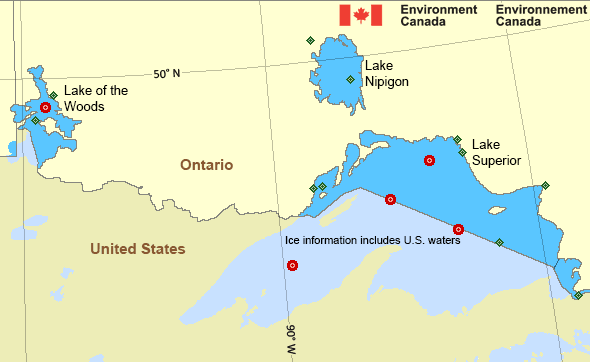
Issued 12:00 PM EDT 9 May 2025 Today Tonight and Saturday Open water except 1 tenth thick lake ice in the extreme northeastern Thunder Bay section. 7 tenths thick lake ice in Nipigon Bay and eastern Black Bay.
*Ice Forecast and Warnings also apply to U.S. waters
Stay connected
Weather Conditions
Zoom-in to make a selection

Legend:
Ice Conditions
*Ice Forecast and Warnings also apply to U.S. waters
Ice Forecasts
Issued 12:00 PM EDT 9 May 2025 Today Tonight and SaturdayIce Coverage
Open water except 1 tenth thick lake ice in the extreme northeastern Thunder Bay section. 7 tenths thick lake ice in Nipigon Bay and eastern Black Bay.
Warnings
No watches or warnings in effect.
Synopsis
Technical Marine Synopsis
Issued 10:30 AM EDT 9 May 2025 Today Tonight and Saturday At 10:30 a.m. EDT today ridge located on a line northeast-southwestover northeastern Ontario.
By 10:30 a.m. EDT Saturday ridge located on a line
northeast-southwest over southern Ontario.
At 10:30 a.m. EDT today cold front located on a line
northeast-southwest over northwestern Ontario.
By 10:30 a.m. EDT Saturday cold front located on a line
northeast-southwest over northeastern Ontario.
Great Lakes - Lake Superior Area
Another Region
- Date modified:
 ATOM
ATOM