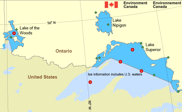
Western Lake Superior
Forecast
Marine Forecast
Issued 03:00 AM EST 05 February 2025
Today Tonight and Thursday.
Gale warning in effect.
Wind northwest 15 knots diminishing to southwest 10 near noon then increasing to south 20 this evening. Wind veering to southwest 25 Thursday morning then increasing to west 35 near noon Thursday. Wind diminishing to northwest 30 Thursday evening.
Scattered flurries ending this morning. Snow beginning near midnight and changing to scattered flurries near noon Thursday. Visibility 1 mile or less in precipitation.
Freezing spray warning in effect.
Risk of freezing spray this morning. Moderate freezing spray beginning Thursday afternoon becoming severe Thursday evening.
Strong wind warning program has ended for the season.
Waves
Extended Forecast
Ice Forecast*
*Ice Forecast and Warnings also apply to U.S. waters
Stay connected
Weather Conditions
Zoom-in to make a selection

Ice Conditions
*Ice Forecast and Warnings also apply to U.S. waters
Ice Forecasts
Issued 12:00 PM EST 4 February 2025 Today Tonight and WednesdayIce Coverage
Open water except 7 tenths thin lake ice including 3 tenths medium
lake ice along parts of the southern shores. 7 tenths medium lake
ice in Thunder Bay. Consolidated thick lake ice in Black Bay,
Nipigon Bay and Chequamegon Bay.
Warnings
Warnings (In effect)
Gale warning in effect
Western Lake Superior
Issued 03:00 AM EST 05 February 2025'Gale' force winds of 34 to 47 knots are occurring or expected to occur in this marine area. Watch for updated statements. Please refer to the latest marine forecasts for further details and continue to monitor the situation through Canadian Coast Guard radio or Weatheradio stations.
Freezing spray warning in effect
Western Lake Superior
Issued 03:00 AM EST 05 February 2025Moderate or severe freezing spray is occurring or expected to occur in this marine area. Please refer to the latest marine forecasts for further details and continue to monitor the situation through Canadian Coast Guard radio or Weatheradio stations.
Synopsis
Technical Marine Synopsis
Issued 3:00 AM EST 5 February 2025 Today Tonight and Thursday At 3:00 a.m. EST today ridge located on a line northwest-southeastover southern Michigan.
By 3:00 a.m. EST Thursday departing ridge located on a line
northwest-southeast over Maine.
By 3:00 a.m. EST Thursday approaching warm front located on a line
east-west over Ohio.
By 3:00 a.m. EST Thursday trough located on a line north-south
over northwestern Ontario.
Great Lakes - Lake Superior Area
Another Region
- Date modified:
 ATOM
ATOM