
York
Forecast
Marine Forecast
Issued 05:00 PM CDT 29 October 2024
Tonight and Wednesday.
Gale warning in effect.
Wind west 20 knots increasing to west 30 late Wednesday morning and to west 35 late Wednesday afternoon. Wind increasing to west 40 Wednesday evening.
Periods of snow Wednesday morning. Visibility 1 mile or less in snow.
Freezing spray warning in effect.
Freezing spray beginning Wednesday afternoon.
Temperatures near minus 1.
Waves
Extended Forecast
Ice Forecast
Stay connected
 ATOM
ATOMWeather Conditions
Zoom-in to make a selection
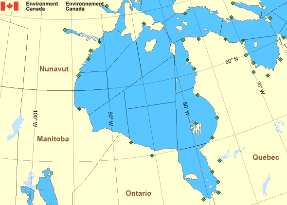
 Buoy
Buoy  Land Station
 Ice Conditions
Ice Forecasts
Issued 11:00 AM EDT 29 October 2024 Today Tonight and WednesdayIce Edge
First ice edge estimated from Ontario near 5628N 8759W to 5713N8908W to 5759N 9215W to 6002N 9403W to Nunavut near 6209N 9236W. Sea
ice south then west of the ice edge.
Second ice edge estimated from Nunavut near 6321N 9041W to 6353N
8830W to 6252N 8547W to 6326N 7903W to 6527N 8304W to Nunavut near
6700N 8129W. Sea ice north then west of the ice edge.
Third ice edge estimated from Nunavut near 6742N 8137W to 6738N
7838W to 6626N 7642W to Baffin Island near 6458N 7808W. Sea ice
north then east of the ice edge.
Ice Coverage
Open water.
Warnings
Warnings (In effect)
Gale warning in effect
York
Issued 5:00 PM CDT 29 October 2024'Gale' force winds of 34 to 47 knots are occurring or expected to occur in this marine area. Watch for updated statements. Please refer to the latest marine forecasts for further details and continue to monitor the situation through Canadian Coast Guard radio or Weatheradio stations.
Freezing spray warning in effect
York
Issued 5:00 PM CDT 29 October 2024Moderate or severe freezing spray is occurring or expected to occur in this marine area. Please refer to the latest marine forecasts for further details and continue to monitor the situation through Canadian Coast Guard radio or Weatheradio stations.
Synopsis
Technical Marine Synopsis
Issued 4:45 PM EDT 29 October 2024 Tonight and Wednesday At 0000 UTC Wednesday low 983 mb located at 65N 93W.By 0000 UTC Thursday low 986 mb located at 61N 88W.
Hudson - Hudson Bay Area
- Arviat - eastern half
- Arviat - western half
- Baker
- Belcher - northern half
- Belcher - southern half
- Central - eastern half
- Central - western half
- Churchill
- Coats - northern half
- Coats - southern half
- East Foxe
- Frobisher Bay
- James Bay
- Lake Winnipegosis
- Lake Winnipeg - north basin
- Northwest Labrador Sea
- North Labrador Coast
- Nottingham - eastern half
- Nottingham - western half
- Puvirnituq - northern half
- Puvirnituq - southern half
- Rankin - northern half
- Rankin - southern half
- Resolution - eastern half
- Resolution - western half
- Roes Welcome
- South Hudson
- South-central Hudson - eastern half
- South-central Hudson - western half
- Ungava - eastern half
- Ungava - western half
- West Brevoort - southern half
- West Foxe
- York
Another Region
Features
WeatherCAN

Download and use the WeatherCAN app on your mobile device
- Date modified: