
Northwest Labrador Sea
Forecast
Marine Forecast
Issued 04:00 AM NDT 23 May 2025
Today Tonight and Saturday.
Wind northwest 15 to 20 knots increasing to northwest 25 near noon then diminishing to northwest 15 to 20 near noon Saturday.
Temperatures near zero.
Waves
Issued 06:00 PM NDT 22 May 2025
Tonight and Friday.
Outside the ice edge seas 2 metres building to 2 to 3 Friday
morning.
Extended Forecast
Issued 04:00 AM NDT 23 May 2025
Sunday
Wind northwest 15 knots increasing to northwest
25 in the afternoon.
Monday
Wind northwest 25 knots.
Tuesday
Wind southwest 20 knots veering to northwest
25.
Ice Forecast
Issued 10:00 AM EDT 22 May 2025 Today Tonight and Friday 1 tenth first-year ice including a trace of old ice except 8 tenths first-year ice including a trace of old ice in the extreme western section.
Stay connected
 ATOM
ATOMWeather Conditions
Zoom-in to make a selection
Legend:
 Buoy
Buoy  Land Station
 Ice Conditions
Ice Forecasts
Issued 10:00 AM EDT 22 May 2025 Today Tonight and FridayIce Edge
First ice edge estimated from 5059N 5713W to Newfoundland near 5113N 5647W. Sea ice north of the ice edge.Second ice edge estimated from Newfoundland near 5123N 5530W to 5138N 5439W to 5527N 5440W to 5708N 5743W to 6200N 5921W then northeastward. Sea ice west of the ice edge.
Ice Coverage
1 tenth first-year ice including a trace of old ice except 8 tenths first-year ice including a trace of old ice in the extreme western section.
Iceberg Bulletin
Issued 2:30 PM EDT 22 May 2025Iceberg Limit
Iceberg limit at 0000 UTC 23 May estimated from Newfoundland near 4710N 5518W to 4115N 5205W to 4110N 4555W to 4825N 4035W to 5320N 4815W to 5915N 5605W to 5755N 5155W to 5900N 4845W then eastward.Iceberg Count
Unknown number of icebergs.Warnings
No watches or warnings in effect.
Synopsis
Technical Marine Synopsis
Issued 4:00 AM NDT 23 May 2025 Today Tonight and Saturday At 4:00 a.m. NDT today ridge located from Ungava Bay toNewfoundland.
By 4:00 a.m. NDT Saturday ridge located from Ungava Bay to Funk
Island Bank.
At 4:00 a.m. NDT today quasi-stationary low 985 mb located east
of Greenland.
Marine Weather Statement
Issued 3:43 AM NDT 23 May 2025 A low pressure system east of Greenland will remain nearly stationarythrough the forecast period. Meanwhile, a ridge of high pressure will
continue to build over Labrador. Strong to gale force northwesterlies
are expected over northeastern waters in between these two features.
Marine interests are advised that a gale warning is in effect for
East Labrador Sea.
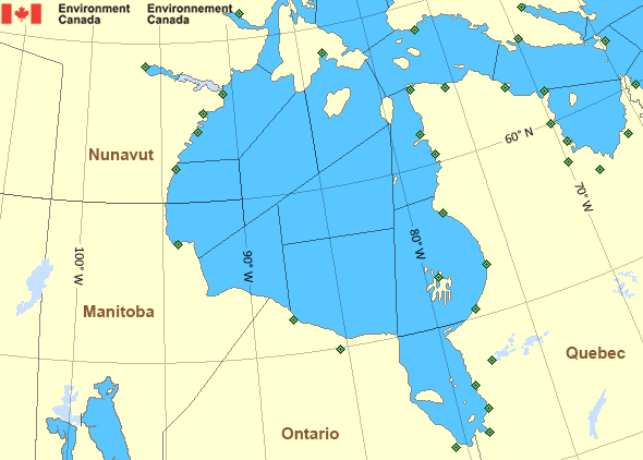
Hudson - Hudson Bay Area
- Arviat - eastern half
- Arviat - western half
- Baker
- Belcher - northern half
- Belcher - southern half
- Central - eastern half
- Central - western half
- Churchill - eastern half
- Churchill - western half
- Coats - northern half
- Coats - southern half
- East Foxe
- Frobisher Bay
- James Bay - northern half
- James Bay - southern half
- Lake Winnipegosis
- Lake Winnipeg - north basin
- Northwest Labrador Sea
- North Labrador Coast
- Nottingham - eastern half
- Nottingham - western half
- Puvirnituq - northern half
- Puvirnituq - southern half
- Rankin
- Resolution - eastern half
- Resolution - western half
- Roes Welcome - northern half
- Roes Welcome - southern half
- South Hudson - eastern half
- South Hudson - western half
- South-central Hudson - eastern half
- South-central Hudson - western half
- Ungava - eastern half
- Ungava - western half
- West Brevoort - southern half
- West Foxe
- York - eastern half
- York - western half
Another Region
- Date modified: