
Coats
Forecast
Marine Forecast
Issued 05:00 AM CST 22 November 2026
Today Tonight and Monday.
Wind north 15 knots backing to west 15 after midnight. Wind west 15 Monday.
Scattered flurries. Visibility as low as 1 mile in flurries.
Freezing spray warning in effect.
Over open water freezing spray ending this evening.
Temperatures minus 8 rising to minus 4 overnight.
Waves
Extended Forecast
Ice Forecast
Stay connected
 ATOM
Weather Conditions
Zoom-in to make a selection
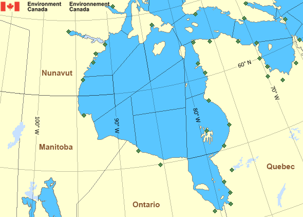
 Buoy
 Land Station
Ice Conditions
Ice Forecasts
Issued 11:00 AM EST 21 November 2026 Today Tonight and SundayIce Edge
First ice edge estimated from Quebec near 5936N 6527W to 5854N 6733Wto 5928N 6909W to 6106N 6901W to 6249N 7412W to 6232N 8013W to 6136N
8037W to 5824N 7855W to Quebec near 5738N 7652W. Sea ice south then
east of the ice edge.
Second ice edge estimated from Ontario near 5448N 8212W to 5507N
8205W to 5914N 9335W to 6259N 8746W to 6119N 8305W to 6412N 7829W to
6346N 7410W to 6231N 7045W to 6153N 6716W to Baffin Island near
6152N 6618W. Sea ice west then north of the ice edge.
Ice Coverage
1 tenth grey ice except 9 tenths new ice including 3 tenths grey ice
along parts of the Southampton Island and Coats Island coasts.
Consolidated grey-white ice in a few bays along the Southampton
Island coast.
Warnings
Warnings (In effect)
Freezing spray warning in effect
Coats
Issued 05:00 AM CST 22 November 2026Moderate or severe freezing spray is occurring or expected to occur in this marine area. Please refer to the latest marine forecasts for further details and continue to monitor the situation through Canadian Coast Guard radio.
Synopsis
Technical Marine Synopsis
Issued 4:45 AM EST 22 November 2026 Today Tonight and Monday At 1200 UTC Sunday building ridge located over western Hudson Bay.By 0000 UTC Tuesday ridge located over Hudson Bay.
At 1200 UTC Sunday weakening low 1001 mb located at 63N 60W.
At 0000 UTC Tuesday low 1006 mb located at 64N 83W.
Hudson - Hudson Bay Area
Another Region
Features
View yesterday's weather data

Check out weather conditions from the previous day using the Past Data link on each location page.
- Date modified: