
North Mackenzie
Forecast
Marine Forecast
Issued 07:00 PM MDT 20 September 2026
Tonight and Monday.
Wind northeast 15 knots diminishing to light early this evening. Wind light Monday.
Flurries this evening and Monday evening.
Temperatures near minus 4.
Waves
Issued 07:00 PM MDT 20 September 2026
Tonight and Monday.
Over open water seas 1 metre or less.
Extended Forecast
Issued 07:00 PM MDT 20 September 2026
Tuesday
Wind southwest 15 knots increasing to
southwest 30 late in the day.
Wednesday
Wind southwest 30 knots diminishing to light
late in the day.
Thursday
Wind light becoming west 15 knots.
Ice Forecast
Issued 10:00 AM EDT 20 September 2026 Today Tonight and Monday 6 tenths old ice.
Stay connected
 ATOM
ATOMWeather Conditions
Zoom-in to make a selection
Legend:
 Buoy
Buoy  Land Station
 Ice Conditions
Ice Forecasts
Issued 10:00 AM EDT 20 September 2026 Today Tonight and MondayIce Edge
First ice edge estimated from Northwest Territories near 7004N12421W to Banks Island near 7105N 12303W. Sea ice west of the ice
edge.
Second ice edge estimated from Banks Island near 7133N 12030W to
Victoria Island near 7138N 11901W. Sea ice north of the ice edge.
Third ice edge estimated from Victoria Island near 6941N 10055W to
7023N 9839W to Prince of Wales Island near 7121N 9912W. Sea ice
northwest of the ice edge.
Fourth ice edge estimated from Prince of Wales Island near 7303N
9752W to Somerset Island near 7325N 9538W. Sea ice north of the ice
edge.
Ice Coverage
6 tenths old ice.
Warnings
No watches or warnings in effect.
Synopsis
Technical Marine Synopsis
Issued 6:30 PM MDT 20 September 2026 Tonight and Monday At 0000 UTC Monday low 982 mb located at 81N 148W.By 0000 UTC Tuesday low 985 mb located at 82N 163W.
At 0000 UTC Monday ridge located from 975N 147W to 79N 88W.
By 0000 UTC Tuesday ridge located from 81N 120W to 71N 137W.
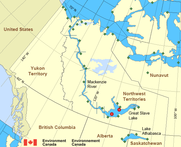
Mackenzie - Mackenzie River Area
- Amundsen
- Axe Point mile 91 to Camsell Bend mile 290
- Baillie
- Banks
- Bathurst
- Bowie - northern half
- Byam
- Camsell Bend mile 290 to Tulita mile 512
- Coronation
- Dease
- Dixon Entrance East
- Dixon Entrance West - east of Langara
- Dixon Entrance West - west of Langara
- Dolphin
- Fort Good Hope mile 684 to Point Separation mile 913
- Great Slave Lake - basin
- Great Slave Lake - east arm
- Great Slave Lake - north arm
- Hecate Strait - northern half
- Lake Athabasca - eastern half
- Lake Athabasca - western half
- Larsen
- Mackenzie
- Maud
- McClintock
- McClure
- Melville
- North Mackenzie
- North Tuktoyaktuk
- Point Separation mile 913 to Kittigazuit Bay mile 1081
- Prince Alfred
- Prince of Wales
- Rae
- Tuktoyaktuk - northern half
- Tuktoyaktuk - southern half
- Tulita mile 512 to Fort Good Hope mile 684
- Ulukhaktok
- West Coast Haida Gwaii - northern half
- Wrigley Harbour mile 0 to Axe Point mile 91
- Yukon Coast
Another Region
Features
Colour-coded weather alerts

Learn more about weather alerting in Canada
- Date modified: