
Mackenzie
Forecast
Marine Forecast
Issued 07:00 PM MDT 26 July 2024
Tonight and Saturday.
Gale warning in effect.
Wind northeast 25 knots increasing to northeast 35 late this evening then diminishing to northeast 25 Saturday evening.
Rain tonight and Saturday. Risk of thunderstorms overnight.
Waves
Extended Forecast
Ice Forecast
Stay connected
 ATOM
ATOMWeather Conditions
Zoom-in to make a selection
 Buoy
Buoy  Land Station
 Ice Conditions
Ice Forecasts
Issued 10:00 AM EDT 26 July 2024 Today Tonight and SaturdayIce Edge
Ice edge is outside the forecast region.Ice Coverage
Bergy water except 1 tenth first-year ice including a trace of old
ice in the extreme northwestern section.
Warnings
Warnings (In effect)
Gale warning in effect
Mackenzie
Issued 7:00 PM MDT 26 July 2024'Gale' force winds of 34 to 47 knots are occurring or expected to occur in this marine area. Watch for updated statements. Please refer to the latest marine forecasts for further details and continue to monitor the situation through Canadian Coast Guard radio or Weatheradio stations.
Synopsis
Technical Marine Synopsis
Issued 6:30 PM MDT 26 July 2024 Tonight and Saturday At 0000 UTC Saturday ridge located from 70N 120W to 73N 168W.By 0000 UTC Sunday ridge located from 74N 120W to 78N 150W.
At 0000 UTC Saturday deepening low 995 mb located at 69N 134W.
By 0000 UTC Sunday low 990 mb located at 66N 123W.
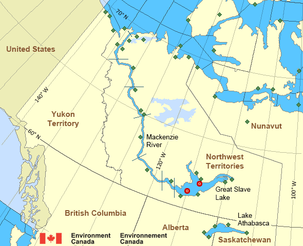
Mackenzie - Mackenzie River Area
- Amundsen
- Axe Point mile 91 to Camsell Bend mile 290
- Baillie
- Banks
- Bathurst
- Bowie - northern half
- Byam
- Camsell Bend mile 290 to Tulita mile 512
- Coronation
- Dease
- Dixon Entrance East
- Dixon Entrance West - east of Langara
- Dixon Entrance West - west of Langara
- Dolphin
- Fort Good Hope mile 684 to Point Separation mile 913
- Great Slave Lake - basin
- Great Slave Lake - east arm
- Great Slave Lake - north arm
- Hecate Strait
- Lake Athabasca - eastern half
- Lake Athabasca - western half
- Larsen
- Mackenzie
- Maud
- McClintock
- McClure
- Melville
- North Mackenzie
- North Tuktoyaktuk
- Point Separation mile 913 to Kittigazuit Bay mile 1081
- Prince Alfred
- Prince of Wales
- Rae
- Tuktoyaktuk - northern half
- Tuktoyaktuk - southern half
- Tulita mile 512 to Fort Good Hope mile 684
- Ulukhaktok
- West Coast Haida Gwaii - northern half
- Wrigley Harbour mile 0 to Axe Point mile 91
- Yukon Coast
Another Region
Features
New Predicting and Alerting Coastal Flooding Program

Find out about coastal flooding coverage, forecasts and warnings in your region
- Date modified: