
Dixon Entrance West - west of Langara
Forecast
Marine Forecast
Issued 04:00 PM PDT 31 May 2025
Tonight and Sunday.
Wind west 15 to 20 knots diminishing to west 10 to 15 late overnight. Wind west 5 to 15 Sunday.
Showers.
Waves
Issued 04:00 PM PDT 31 May 2025
Today Tonight and Sunday.
Seas 2 metres.
Extended Forecast
Issued 04:00 PM PDT 31 May 2025
Monday
Wind west 10 to 20 knots backing to southerly
10 to 20 in the afternoon.
Tuesday
Wind west 5 to 15 knots.
Wednesday
Wind west 10 to 20 knots backing to
southwest 15 to 25 late in the day.
Stay connected
 ATOM
ATOMWeather Conditions
Zoom-in to make a selection
Legend:
 Buoy
Buoy  Land Station
 Ice Conditions
There is no ice forecast issued for this area.
Warnings
No watches or warnings in effect.
Synopsis
Technical Marine Synopsis
Issued 4:00 PM PDT 31 May 2025 Tonight and Sunday At 4:00 p.m. PDT today building ridge located west of the offshorewaters.
By 4:00 a.m. PDT Sunday quasi-stationary ridge located over Bowie.
At 10:30 a.m. PDT Sunday ridge located over Bowie.
By 9:30 p.m. PDT Sunday ridge located over Haida Gwaii to Explorer.
At 4:00 p.m. PDT Sunday frontal system located northwest of Bowie.
Marine Weather Statement
Issued 3:47 PM PDT 31 May 2025 A ridge of high pressure is builiding over offshore waters.Marginal northwesterly gales are expected over west coast Vancouver
Island and Johnstone Strait. Strong northwestly winds are expected
for the rest of the southern waters.
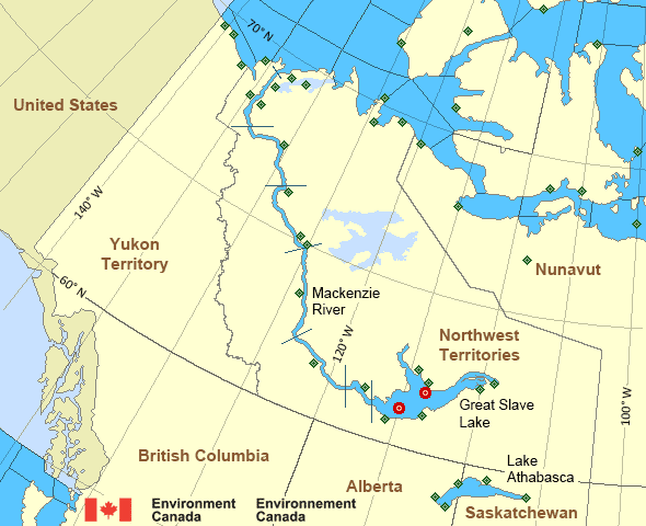
Mackenzie - Mackenzie River Area
- Amundsen
- Axe Point mile 91 to Camsell Bend mile 290
- Baillie
- Banks
- Bathurst
- Bowie - northern half
- Byam
- Camsell Bend mile 290 to Tulita mile 512
- Coronation
- Dease
- Dixon Entrance East
- Dixon Entrance West - east of Langara
- Dixon Entrance West - west of Langara
- Dolphin
- Fort Good Hope mile 684 to Point Separation mile 913
- Great Slave Lake - basin
- Great Slave Lake - east arm
- Great Slave Lake - north arm
- Hecate Strait - northern half
- Lake Athabasca - eastern half
- Lake Athabasca - western half
- Larsen
- Mackenzie
- Maud
- McClintock
- McClure
- Melville
- North Mackenzie
- North Tuktoyaktuk
- Point Separation mile 913 to Kittigazuit Bay mile 1081
- Prince Alfred
- Prince of Wales
- Rae
- Tuktoyaktuk - northern half
- Tuktoyaktuk - southern half
- Tulita mile 512 to Fort Good Hope mile 684
- Ulukhaktok
- West Coast Haida Gwaii - northern half
- Wrigley Harbour mile 0 to Axe Point mile 91
- Yukon Coast
Another Region
- Date modified: