Language selection

Features

Weather shortcuts

Banks

Forecast

Marine Forecast

Issued 07:00 AM MDT 18 August 2026

Today Tonight and Wednesday.

Wind east 15 knots backing to north 20 near noon then increasing to north 25 near midnight. Wind diminishing to northwest 15 near noon Wednesday.

Showers ending this evening with a risk of thunderstorms. Fog patches dissipating Wednesday afternoon.

Temperatures plus 7 falling to minus 1 Wednesday evening.

Waves

Issued 07:00 AM MDT 18 August 2026
Today Tonight and Wednesday. Over open water seas 1 metre or less.

Extended Forecast

Issued 07:00 AM MDT 18 August 2026
Thursday Wind light.
Friday Wind light increasing to southeast 20 knots.
Saturday Wind southeast 20 knots.

Ice Forecast

Issued 10:00 AM EDT 18 August 2026 Today Tonight and Wednesday 2 tenths old ice except 6 tenths old ice in the western section. 

[ Canadian Ice Service ]

Stay connected

ATOM

Weather Conditions

Skip Image

Zoom-in to make a selection

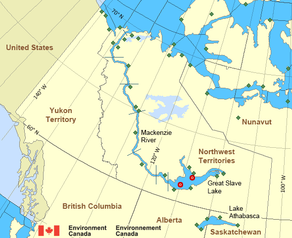
Map of Mackenzie - Mackenzie River marine weather areas Kugluktuk Airport Great Slave Lake - 45141 Keats Point Łutselk'e Airport Storm Hills Hay River/Merlyn Carter Airport Norman Wells Airport Cape Peel West Paulatuk Airport Great Slave Lake North Arm - 45150 Liverpool Bay Pelly Island Hat Island Tuktoyaktuk Airport Wrigley Airport Yellowknife Airport Bathurst Inlet Croker River Sachs Harbour Airport Thomsen River Ulukhaktok Airport Prairie River Egg Island Fort Chipewyan Airport Stony Rapids Airport Uranium City Cape Providence Komakuk Beach Little Chicago Cambridge Bay Airport Shingle Point Airport Inuvik Airport Aklavik Airport Cape Parry Airport Herschel Island Gateshead Island Fort Good Hope Airport Stefansson Island Tulita Airport Fort Providence Fort Reliance Fort Resolution Airport Fort Simpson Airport Inner Whaleback Rocks
Legend:
buoy Buoy
land station Land Station
Ice Conditions

Ice Forecasts

Issued 10:00 AM EDT 18 August 2026 Today Tonight and Wednesday

Ice Edge

First ice edge estimated from Brodeur Peninsula near 7154N 9004W to
7115N 9200W to Nunavut near 7037N 9210W. Sea ice southeast of the
ice edge.

Second ice edge estimated from Nunavut near 6857N 11659W to 7030N
11900W to Victoria Island near 7136N 11854W. Sea ice west of the ice
edge.

Third ice edge estimated from Victoria Island near 6901N 10147W to
6930N 10000W to 7030N 9900W to Prince of Wales Island near 7214N
10128W. Sea ice west of the ice edge.

Fourth ice edge estimated from Prince of Wales Island near 7244N
9630W to Somerset Island near 7320N 9538W. Sea ice northwest of the
ice edge.

Ice Coverage

2 tenths old ice except 6 tenths old ice in the western section.

Warnings

No watches or warnings in effect.

Synopsis

Technical Marine Synopsis

Issued 6:30 AM MDT 18 August 2026 Today Tonight and Wednesday At 1200 UTC Tuesday low 987 mb located at 85N 147W.
By 0000 UTC Thursday low 993 mb located at 84N 155W.

At 1200 UTC Tuesday low 995 mb located at 70N 135W.
By 0000 UTC Thursday low 994 mb located at 72N 107W.

Mackenzie - Mackenzie River Area

Another Region

Features

Colour-coded weather alerts

Learn more about weather alerting in Canada

Thunderstorm Outlooks

Find the Thunderstorm Outlook for your area.

Improved storm alerts

Learn more about targeted warnings for severe thunderstorms and tornadoes

Date modified: