Language selection

Weather shortcuts

Amundsen

Forecast

Marine Forecast

Issued 07:00 PM MDT 15 September 2026

Tonight and Wednesday.

Wind west 20 knots backing to south 15 Wednesday afternoon.

Periods of snow ending overnight with a risk of freezing drizzle. Showers Wednesday evening. Visibility as low as 1 mile in snow.

Low tonight minus 1. High Wednesday plus 5.

Waves

Issued 07:00 PM MDT 15 September 2026
Tonight and Wednesday. Over open water seas 2 metres subsiding to 1 early Wednesday evening.

Extended Forecast

Issued 07:00 PM MDT 15 September 2026
Thursday Wind south 15 knots increasing to west 25 in the morning then veering to northwest 30 in the afternoon.
Friday Wind northwest 30 knots diminishing to south 10 to 15.
Saturday Wind west 15 to 20 knots diminishing to light.

Ice Forecast

Issued 10:00 AM EDT 15 September 2026 Today Tonight and Wednesday Bergy water. 

[ Canadian Ice Service ]

Stay connected

ATOM

Weather Conditions

Skip Image

Zoom-in to make a selection

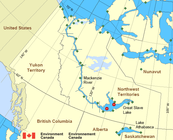
Map of Mackenzie - Mackenzie River marine weather areas Kugluktuk Airport Great Slave Lake - 45141 Keats Point Łutselk'e Airport Storm Hills Hay River/Merlyn Carter Airport Norman Wells Airport Cape Peel West Paulatuk Airport Great Slave Lake North Arm - 45150 Liverpool Bay Pelly Island Hat Island Tuktoyaktuk Airport Wrigley Airport Yellowknife Airport Bathurst Inlet Croker River Sachs Harbour Airport Thomsen River Ulukhaktok Airport Prairie River Egg Island Fort Chipewyan Airport Stony Rapids Airport Uranium City Cape Providence Komakuk Beach Little Chicago Cambridge Bay Airport Shingle Point Airport Inuvik Airport Aklavik Airport Cape Parry Airport Herschel Island Gateshead Island Fort Good Hope Airport Stefansson Island Tulita Airport Fort Providence Fort Reliance Fort Resolution Airport Fort Simpson Airport Inner Whaleback Rocks
Legend:
buoy Buoy
land station Land Station
Ice Conditions

Ice Forecasts

Issued 10:00 AM EDT 15 September 2026 Today Tonight and Wednesday

Ice Edge

First ice edge estimated from Northwest Territories near 6943N
12404W to 7007N 12125W to Banks Island near 7157N 12547W. Sea ice
west of the ice edge.

Second ice edge estimated from Banks Island near 7133N 12030W to
Victoria Island near 7138N 11901W. Sea ice north of the ice edge.

Third ice edge estimated from Victoria Island near 6953N 10052W to
7023N 9839W to Prince of Wales Island near 7158N 10017W. Sea ice
northwest of the ice edge.

Fourth ice edge estimated from Prince of Wales Island near 7315N
9750W to Somerset Island near 7317N 9535W. Sea ice north of the ice
edge.

Ice Coverage

Bergy water.

Warnings

No watches or warnings in effect.

Synopsis

Technical Marine Synopsis

Issued 6:21 PM MDT 15 September 2026 Tonight and Wednesday At 0000 UTC Wednesday low 975 mb located at 82N 131W.
By 0000 UTC Thursday low 977 mb located at 83N 116W.

At 0000 UTC Wednesday departing ridge from 1022 mb high located
from 63N 122W to 73N 168W.

At 0000 UTC Thursday low 999 mb located at 70N 136W.

Mackenzie - Mackenzie River Area

Another Region

Features

Colour-coded weather alerts

Learn more about weather alerting in Canada

Improved storm alerts

Learn more about targeted warnings for severe thunderstorms and tornadoes

Date modified: