
Mackenzie
Forecast
Marine Forecast
Issued 07:00 AM MDT 07 October 2026
Today Tonight and Thursday.
Wind northeast 15 knots diminishing to light near midnight then increasing to southeast 15 near noon Thursday. Wind increasing to south 25 Thursday evening.
Scattered flurries ending Thursday morning.
Temperatures near minus 3.
Waves
Extended Forecast
Ice Forecast
Stay connected
 ATOM
Weather Conditions
Zoom-in to make a selection
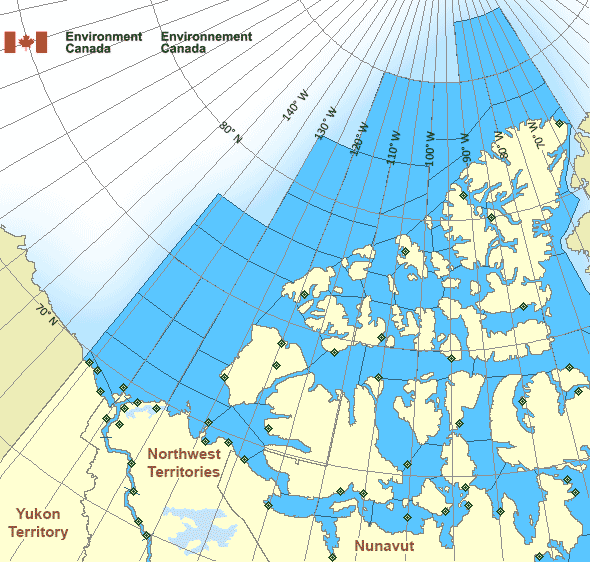
 Buoy
 Land Station
Ice Conditions
Ice Forecasts
Issued 10:00 AM EDT 7 October 2026 Today Tonight and ThursdayIce Edge
First ice edge estimated from Northwest Territories near 6942N13420W to Banks Island near 7157N 12549W. Sea ice northwest of the
ice edge.
Second ice edge estimated from Banks Island near 7130N 12037W to
Victoria Island near 7136N 11854W. Sea ice north of the ice edge.
Third ice edge estimated from Victoria Island near 6940N 10139W to
6918N 10129W to 6917N 9925W to Prince of Wales Island near 7118N
9832W. Sea ice north then west of the ice edge.
Fourth ice edge estimated from Prince of Wales Island near 7234N
9624W to Somerset Island near 7233N 9519W. Sea ice north of the ice
edge.
Fifth ice edge estimated from Somerset Island near 7200N 9401W to
7159N 9340W to 7228N 9259W to Brodeur Peninsula near 7303N 8918W.
Sea ice northwest of the ice edge.
Sixth ice edge estimated from Boothia Peninsula near 7122N 9300W to
7146N 9257W to Boothia Peninsula near 7155N 9424W. Sea ice southwest
of the ice edge.
Ice Coverage
Special ice warning in effect.1 tenth multi-year ice except 3 tenths multi-year ice in the
northwestern section.
Unusual presence of multi-year ice in the southwestern section today
and continuing Thursday.
Warnings
Warnings (In effect)
Special ice warning in effect
Mackenzie
Issued 10:00 AM EDT 07 October 2026Navigators in this marine area should be on the lookout for hazardous ice conditions and take necessary safety precautions. Please refer to the latest ice forecasts for further details and continue to monitor the situation through Canadian Coast Guard radio stations.
Synopsis
Technical Marine Synopsis
Issued 6:30 AM MDT 7 October 2026 Today Tonight and Thursday At 1200 UTC Wednesday high 1024 mb located at 74N 147W.By 0000 UTC Friday high 1030 mb located at 73N 123W.
By 0000 UTC Friday approaching low 997 mb located at 79N 167W.
Arctic - Western Arctic Area
- Admiralty
- Alert
- Amundsen
- Axel Heiberg
- Baillie
- Ballantyne
- Banks
- Barrow
- Bartlett
- Bathurst
- Boothia
- Borden
- Brock
- Byam
- Camsell Bend mile 290 to Tulita mile 512
- Clarence - northern half
- Clarence - southern half
- Committee
- Coronation
- CT4
- CU4
- CV4
- CV5
- CW3
- CW4
- CW5
- CX4
- Dease
- Dolphin
- East Baffin - northern half
- Ellef Ringnes
- Ellesmere
- Eureka - northern half
- Eureka - southern half
- Fitzwilliam
- Fort Good Hope mile 684 to Point Separation mile 913
- Greely
- Griper
- Gustaf
- Hassel
- Hazen
- Igloolik
- Jones - eastern half
- Jones - western half
- Kane - northern half
- Kane - southern half
- Lancaster - eastern half
- Lancaster - western half
- Larsen
- Liddon
- Mackenzie
- Maclean
- Massey
- Maud
- McClintock
- McClure
- Melville
- Nansen
- Navy Board
- Northwest Beaufort
- North Mackenzie
- North Prince Patrick
- North Sverdrup
- North Tuktoyaktuk
- Norwegian
- Peary
- Peel
- Point Separation mile 913 to Kittigazuit Bay mile 1081
- Pond
- Prince Alfred
- Prince of Wales
- Prince Patrick
- Queens
- Rae
- Regent
- Robeson - northern half
- Robeson - southern half
- Roes Welcome
- South Axel Heiberg
- South Ellef Ringnes
- South Prince Patrick
- South Sverdrup
- St. Roch
- Tuktoyaktuk - northern half
- Tuktoyaktuk - southern half
- Tulita mile 512 to Fort Good Hope mile 684
- Ulukhaktok
- Ward Hunt
- West Baffin - northern half
- West Baffin - southern half
- West Foxe
- West Prince Alfred
- Wilkins
- Yukon Coast
Another Region
- Date modified: