
Juan de Fuca Strait - west entrance
Forecast
Marine Forecast
Issued 04:00 PM PDT 12 March 2025
Tonight and Thursday.
Wind light becoming westerly 5 to 15 knots this evening. Wind southwesterly 5 to 15 Thursday.
Showers.
Strong wind warning program has ended for the season.
Extended Forecast
Issued 04:00 PM PDT 12 March 2025
Friday
Wind east 10 to 20 knots increasing to east 20
to 30 in the morning.
Saturday
Wind east 10 to 20 knots becoming southwest
10 to 20.
Sunday
Wind east 10 to 20 knots increasing to west 20
to 30.
Stay connected
 ATOM
ATOMWeather Conditions
Zoom-in to make a selection
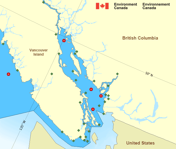
Legend:
 Buoy
Buoy  Land Station
 Ice Conditions
There is no ice forecast issued for this area.
Warnings
No watches or warnings in effect.
Synopsis
Technical Marine Synopsis
Issued 4:00 PM PDT 12 March 2025 Tonight and Thursday At 4:00 p.m. PDT today ridge located west of the offshore waters.By 9:30 p.m. PDT tonight weakening ridge located west of the
offshore waters.
Marine Weather Statement
Issued 10:13 AM PDT 12 March 2025 A low pressure centre will track northwards and move onto the CentralCoast by midday.
Ahead of the low, strong to gale force southeasterlies over the
Northern Strait of Georgia will ease near noon today.
A ridge of high pressure over Northern BC combined with the low will
give strong to gale force northeast outflow winds to Dixon Entrance
East until this afternoon.
Pacific - Georgia Basin Area
Another Region
- Date modified: