Language selection

Weather shortcuts

Haro Strait

Forecast

Marine Forecast

Issued 04:00 AM PDT 09 September 2026

Today Tonight and Thursday.

Strong wind warning in effect.

Wind light becoming northerly 10 knots early this morning then becoming southeast 10 early this afternoon. Wind becoming southwest 5 to 15 early this evening except southwest 20 to 25 over southern sections tonight. Wind becoming light Thursday morning then becoming southeast 10 Thursday afternoon. Wind becoming southwest 5 to 15 Thursday evening.

Extended Forecast

Issued 04:00 AM PDT 09 September 2026
Friday Wind southwest 5 to 15 knots becoming light late in the day.
Saturday Wind light becoming southwest 5 to 15 knots late in the day.
Sunday Wind southwest 5 to 15 knots.

Stay connected

ATOM

Weather Conditions

Skip Image

Zoom-in to make a selection

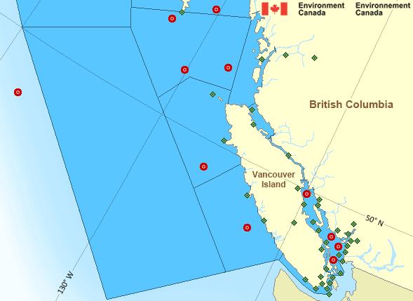
Map of Pacific - South Coast marine weather areas Cape St.James West Vancouver Victoria Gonzales University of Victoria South Brooks - 46132 Sheringham Point Bella Bella Airport Saturna Island Bella Coola Airport Sentry Shoal - 46131 Race Rocks Lightstation Cathedral Point South Nomad - 46036 Kelp Reefs Herbert Island Esquimalt Harbour Point Atkinson Georgia Strait - 46303 Sand Heads Lightstation Tsawwassen Ferry Terminal English Bay – 46304 Vancouver Int'l Airport Vancouver Harbour Discovery Island Entrance Island Sartine Island Fanny Island Comox Airport Nanaimo Airport South Moresby - 46147 Port Hardy Airport Sisters Islets South Hecate Strait - 46185 Estevan Point Campbell River Airport Port Alberni West Sea Otter - 46204 Halibut Bank - 46146 Solander Island Tofino Airport Ballenas Islands Grief Point La Perouse Bank - 46206 Howe Sound - Pam Rocks Powell River Airport Sechelt East Dellwood - 46207 Squamish Airport Victoria Int'l Airport
Legend:
buoy Buoy
land station Land Station
Ice Conditions

There is no ice forecast issued for this area.

Warnings

Warnings (In effect)

Strong wind warning in effect

Haro Strait

Issued 08:08 AM PDT 09 September 2026

'Strong' winds of 20 to 33 knots are occurring or expected to occur in this marine area. Please refer to the latest marine forecasts for further details and continue to monitor the situation through Canadian Coast Guard radio.

Synopsis

Technical Marine Synopsis

Issued 4:00 AM PDT 9 September 2026 Today Tonight and Thursday At 4:00 a.m. PDT today weakening ridge located from Explorer to
the Central Coast.
By 4:00 p.m. PDT today weakening ridge located over southern
Explorer.

At 4:00 a.m. PDT today cold front located on a line
northeast-southwest over northern Bowie.
By 4:00 p.m. PDT today cold front located on a line
northeast-southwest over the Central Coast.

At 4:00 a.m. PDT Thursday departing cold front located on a line
northeast-southwest over southern BC interior.

Marine Weather Statement

Issued 3:46 AM PDT 9 September 2026 A cold front over Bowie will move southeastward across the marine
regions today and tonight. With passage of the front, westerly
marginal gales over northern waters will ease this morning.

The front will reach southern waters tonight spreading strong to
marginal gale force northwesterly and westerly winds to the region.

Pacific - South Coast Area

Another Region

Features

Colour-coded weather alerts

Learn more about weather alerting in Canada

Improved storm alerts

Learn more about targeted warnings for severe thunderstorms and tornadoes

Date modified: