
Dixon Entrance West - east of Langara
Forecast
Marine Forecast
Issued 09:30 PM PDT 14 October 2026
Tonight and Thursday.
Gale warning in effect.
Wind southeast 25 knots increasing to southeast 35 to 45 after midnight. Wind southeast 35 to 45 Thursday.
Rain overnight and Thursday.
Waves
Issued 04:00 PM PDT 14 October 2026
Today Tonight and Thursday.
Seas 1 metre building to 2 after midnight and to 3 to 4 early
Thursday morning.
Extended Forecast
Issued 04:00 PM PDT 14 October 2026
Friday
Wind southeast 35 to 45 knots diminishing to
southwest 10 to 20 in the morning.
Saturday
Wind southwest 15 to 25 knots.
Sunday
Wind southwest 15 to 25 knots backing to
southeast 15 to 25.
Stay connected
 ATOM
ATOMWeather Conditions
Zoom-in to make a selection
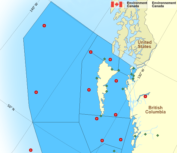
Legend:
 Buoy
Buoy  Land Station
 Ice Conditions
There is no ice forecast issued for this area.
Warnings
Warnings (In effect)
Gale warning in effect
Dixon Entrance West - east of Langara
Issued 9:30 PM PDT 14 October 2026'Gale' force winds of 34 to 47 knots are occurring or expected to occur in this marine area. Watch for updated statements. Please refer to the latest marine forecasts for further details and continue to monitor the situation through Canadian Coast Guard radio.
Synopsis
Technical Marine Synopsis
Issued 9:30 PM PDT 14 October 2026 Tonight and Thursday At 9:30 p.m. PDT tonight intensifying frontal system located westof the offshore waters.
By 4:00 a.m. PDT Thursday frontal system located on a line
north-south over western Bowie.
At 2:00 p.m. PDT Thursday frontal system located over Haida Gwaii
extending southwestward.
By 4:00 a.m. PDT Friday departing frontal system located over
Hecate Strait.
Marine Weather Statement
Issued 9:22 PM PDT 14 October 2026 A strong frontal system will approach Bowie tonight. Gale to stormforce southeasterlies over Bowie will spread across the northern and
central waters overnight and Thursday morning.
The front will stall off the west coast of Haida Gwaii Thursday
afternoon and evening before moving inland early Friday morning.
Gale to storm force southeasterlies ahead of the front will ease to
moderate to strong westerlies in its wake.
Pacific - North Coast Area
Another Region
- Date modified: