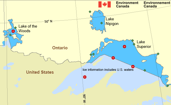
Whitefish Bay: Regional Summary
Land Stations
[ Buoys ]
| Wind(knots) | Conditions | Visibility(km) | Pressure(kPa) | Air temp(°C) | Relative humidity(%) | Dew point(°C) |
|---|---|---|---|---|---|---|
| Armstrong Airport 10:11 PM EDT 17 April 2024 | ||||||
| SE 5 | Light Rain | 5 | 101.1 | 1 | 98 | 1 |
| Cameron Falls 10:00 PM EDT 17 April 2024 | ||||||
| N 4 | N/A | N/A | 101.0 | 2 | 96 | 2 |
| Geraldton Airport 10:18 PM EDT 17 April 2024 | ||||||
| ENE 6 | Light Rain | 10 | 101.1 | 1 | 100 | 1 |
| Kenora Airport 09:40 PM CDT 17 April 2024 | ||||||
| SSW 5 | Fog | 0.6 | 101.0 | 3 | 99 | 3 |
| Little Flatland Island 10:00 PM EDT 17 April 2024 | ||||||
| E 5 | N/A | N/A | 101.1 | 1 | 95 | 0 |
| Marathon Airport 10:00 PM EDT 17 April 2024 | ||||||
| ENE 8 | N/A | N/A | 100.9 | 3 | 99 | 2 |
| Pukaskwa National Park 10:00 PM EDT 17 April 2024 | ||||||
| ENE 6 | N/A | N/A | 100.9 | 3 | 96 | 3 |
| Royal Island 09:00 PM CDT 17 April 2024 | ||||||
| N/A | N/A | N/A | 101.0 | 3 | N/A | N/A |
| Sault Ste. Marie Airport 10:00 PM EDT 17 April 2024 | ||||||
| E 11 gusts 20 | Light Rainshower | 8 | 100.7 | 6 | 100 | 6 |
| Thunder Bay Airport 10:00 PM EDT 17 April 2024 | ||||||
| WNW 3 | Light Rain | 8 | 100.9 | 4 | 98 | 3 |
| Wawa Airport 10:00 PM EDT 17 April 2024 | ||||||
| NE 7 | N/A | N/A | 100.9 | 5 | 91 | 3 |
| Welcome Island 10:00 PM EDT 17 April 2024 | ||||||
| NE 11 | N/A | N/A | 100.9 | 3 | 99 | 3 |
If you require additional historical weather information, please visit Climate Data Online
[ Buoys ]
[ Land Stations ]
Zoom-in to make a selection

Legend:
Great Lakes - Lake Superior Area
Another Region
- Date modified: